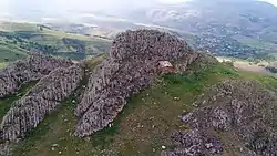
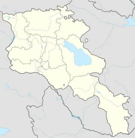
Shaghat
Շաղատ | |
|---|---|
 | |
 Shaghat 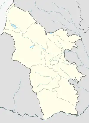 Shaghat | |
| Coordinates: 39°33′42″N 45°54′44″E / 39.56167°N 45.91222°E | |
| Country | Armenia |
| Province | Syunik |
| Municipality | Sisian |
| Area | |
| • Total | 48.29 km2 (18.64 sq mi) |
| Population | |
| • Total | 969 |
| • Density | 20/km2 (52/sq mi) |
| Time zone | UTC+4 (AMT) |
| Shaghat at GEOnet Names Server | |
Shaghat (Armenian: Շաղատ) is a village in the Sisian Municipality of the Syunik Province in Armenia.
Demographics
The Statistical Committee of Armenia reported its population was 1,219 in 2010,[3] up from 1,049 at the 2001 census.[4]
Gallery
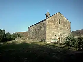 St. Gevorg Church in Shaghat
References
Wikimedia Commons has media related to Shaghat.
- ↑ "Syunik regional e-Governance System" (in Armenian). Syunik Province provincial government. Click on link entitled "Համայնքներ" (community) and search for the place by Armenian name.
- ↑ Statistical Committee of Armenia. "The results of the 2011 Population Census of Armenia" (PDF).
- ↑ "Marzes of Armenia and Yerevan City in Figures, 2010" (PDF). Statistical Committee of Armenia.
- ↑ Report of the results of the 2001 Armenian Census, Statistical Committee of Armenia

This article is issued from Wikipedia. The text is licensed under Creative Commons - Attribution - Sharealike. Additional terms may apply for the media files.