| Shannonvale Queensland | |||||||||||||||
|---|---|---|---|---|---|---|---|---|---|---|---|---|---|---|---|
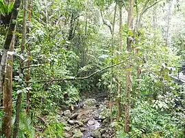
 Shannonvale rainforest, 2013 | |||||||||||||||
 Shannonvale | |||||||||||||||
| Coordinates | 16°30′47″S 145°19′28″E / 16.5130°S 145.3244°E | ||||||||||||||
| Population | 202 (2016 census)[1] | ||||||||||||||
| • Density | 2.385/km2 (6.177/sq mi) | ||||||||||||||
| Postcode(s) | 4873 | ||||||||||||||
| Area | 84.7 km2 (32.7 sq mi) | ||||||||||||||
| Time zone | AEST (UTC+10:00) | ||||||||||||||
| LGA(s) | Shire of Douglas | ||||||||||||||
| State electorate(s) | Cook | ||||||||||||||
| Federal division(s) | Leichhardt | ||||||||||||||
| |||||||||||||||
Shannonvale is a rural locality in the Shire of Douglas, Queensland, Australia.[2] In the 2016 census Shannonvale had a population of 202 people.[1]
Geography
The Great Dividing Range passes through the location, which has the following named peaks:[3]
- Mount Demi (Manjal Dimbi) (16°29′52″S 145°19′24″E / 16.4979°S 145.3233°E) 1,025 metres (3,363 ft) above sea level[4][5]
- Perseverance Mountain (The Lookout) (16°33′03″S 145°19′33″E / 16.5509°S 145.3259°E) 917 metres (3,009 ft)[4][6]
- Round Mountain (16°31′20″S 145°18′36″E / 16.5222°S 145.3101°E) 1,009 metres (3,310 ft)[4][7]
- The Bluff (16°29′55″S 145°19′27″E / 16.4985°S 145.3243°E) 1,285 metres (4,216 ft)[4][8]
History
In the 2016 census Shannonvale had a population of 202 people.[1]
References
Wikimedia Commons has media related to Shannonvale, Queensland.
- 1 2 3 Australian Bureau of Statistics (27 June 2017). "Shannonvale (SSC)". 2016 Census QuickStats. Retrieved 20 October 2018.
- ↑ "Shannonvale – locality in Shire of Douglas (entry 48865)". Queensland Place Names. Queensland Government. Retrieved 27 December 2020.
- ↑ "Queensland Globe". State of Queensland. Retrieved 26 January 2021.
- 1 2 3 4 "Mountain peaks and capes - Queensland". Queensland Open Data. Queensland Government. 12 November 2020. Archived from the original on 25 November 2020. Retrieved 25 November 2020.
- ↑ "Mount Demi – mountain in Douglas Shire (entry 9715)". Queensland Place Names. Queensland Government. Retrieved 25 November 2020.
- ↑ "Perseverance Mountain – mountain in Douglas Shire (entry 26490)". Queensland Place Names. Queensland Government. Retrieved 25 November 2020.
- ↑ "Round Mountain – mountain in Douglas Shire (entry 29185)". Queensland Place Names. Queensland Government. Retrieved 25 November 2020.
- ↑ "The Bluff – mountain in Douglas Shire (entry 50300)". Queensland Place Names. Queensland Government. Retrieved 25 November 2020.
This article is issued from Wikipedia. The text is licensed under Creative Commons - Attribution - Sharealike. Additional terms may apply for the media files.