Shaptul
شاپتۇل بازىرى 夏普吐勒镇 Xaptul; Xiaputule | |
|---|---|
Town | |
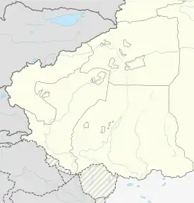
 Shaptul Location in Xinjiang | |
| Coordinates: 39°28′06″N 076°37′04″E / 39.46833°N 76.61778°E | |
| Country | China |
| Autonomous Region | Xinjiang |
| Prefecture | Kashgar |
| County | Payzawat/Jiashi |
| Area | |
| • Total | 236 km2 (91 sq mi) |
| Population (2010)[2] | |
| • Total | 28,944 |
| Ethnic groups | |
| • Major ethnic groups | Uyghur[1] |
| Time zone | UTC+8 (China Standard) |
Shaptul also been written as Xiabutuoqu ,Xiaputule and Xaptul.[3][4] is a town in Payzawat County, Kashgar Prefecture, Xinjiang, China.
History
1958, Shaptul was part of Gaochao Commune.1964, Xiafutao Commune was created from part of Gaochao Commune.1966, the commune was renamed Dongfeng Commune.1984, the commune was made into Shaptul Township.[1]2014, Shaptul Township was disestablished and Shaptul Town was created.[5]
Administrative divisions
Shaptul includes twenty-four villages (PRC Hanyu Pinyin-derived names, except where Uyghur is provided):[6]
- Yang'airike, Kamatierike, Zhahongla, Jiayi'airike (Jiayi Airikecun;[7] 39°28′56″N 076°38′17″E / 39.48222°N 76.63806°E, Tuowanjiayi'airike, Dun'aireke , Arexiaputule , Timu (Timucun;[8] 39°32′02″N 076°40′50″E / 39.53389°N 76.68056°E, Milike (Milikecun;[9] 39°31′29″N 076°39′30″E / 39.52472°N 76.65833°E, Yikensu (Yikensucun;[10] ) 39°30′34″N 076°30′49″E / 39.50944°N 76.51361°E, Keman , Langan , Bayi'airike, Qazanköl ([11] / Kazankuli, Anjiang'airike, Qina'airike , Tuoshikanla (Tuoshi Kanlacun;[12]39°27′40″N 076°35′54″E / 39.46111°N 76.59833°E, Bayituokayi, Qiayila, Qiong'a'airike, Keqike'a'airike, Kumudun, Bazha , Hongqi
See also
References
Look up Shaptul in Wiktionary, the free dictionary.
- 1 2 3 1997年伽师县行政区划. XZQH.org (in Simplified Chinese). 19 November 2010. Archived from the original on 16 December 2020. Retrieved 16 December 2020.
- ↑ 伽师县历史沿革. XZQH.org. 14 November 2014. Archived from the original on 20 March 2020. Retrieved 21 March 2020.
2010年第六次人口普查,伽师县常住总人口381767人,{...}夏普吐勒乡28944人,
- ↑ Zhong Xingqi, ed. (July 2008). 西域地名考录 (in Simplified Chinese). Beijing: 国家图书馆出版社. p. 1034. ISBN 978-7-5013-3628-9.
- ↑ TF Li, K Gulina, T Wang (1996). "A study on the prevention and therapy of carcinoma of the cervix in Xaptul township, Jashi County, Xinjiang". Acta Acad Med Xinjiang.
{{cite journal}}: CS1 maint: multiple names: authors list (link) - ↑ 新疆维吾尔自治区人民政府关于同意伽师县夏普吐勒乡撤乡设镇的批复(新政函〔2014〕183号) (in Simplified Chinese). Archived from the original on 2019-08-12. Retrieved 2017-09-20.
- ↑ 2020年统计用区划代码和城乡划分代码:夏普吐勒镇 [2020 Statistical Area Numbers and Rural-Urban Area Numbers: Shaptul Town] (in Simplified Chinese). National Bureau of Statistics of the People's Republic of China. 2020. Retrieved 16 December 2020.
- ↑ Jiayi Airikecun (Approved - N) at GEOnet Names Server, United States National Geospatial-Intelligence Agency
- ↑ Timucun (Approved - N) at GEOnet Names Server, United States National Geospatial-Intelligence Agency
- ↑ Milikecun (Approved - N) at GEOnet Names Server, United States National Geospatial-Intelligence Agency
- ↑ Yikensucun (Approved - N) at GEOnet Names Server, United States National Geospatial-Intelligence Agency
- ↑ پەيزاۋات ناھىيەسى ئېتىز باشلىرىدا لېكسىيە سۆزلەش پائالىيىتى ئېلىپ باردى. جۇڭگو قەشقەر تورى 中国喀什网 (in Uyghur). 2017-03-20. Archived from the original on 16 December 2020. Retrieved 16 December 2020.
شاپتۇل بازىرى قازانكۆل كەنت
- ↑ Tuoshi Kanlacun (Approved - N) at GEOnet Names Server, United States National Geospatial-Intelligence Agency
This article is issued from Wikipedia. The text is licensed under Creative Commons - Attribution - Sharealike. Additional terms may apply for the media files.