Sherman Township | |
|---|---|
 Location in Leavenworth County | |
| Coordinates: 38°59′17″N 94°57′47″W / 38.98806°N 94.96306°W | |
| Country | United States |
| State | Kansas |
| County | Leavenworth |
| Area | |
| • Total | 41.26 sq mi (66.40 km2) |
| • Land | 40.11 sq mi (64.55 km2) |
| • Water | 1.15 sq mi (1.85 km2) |
| Elevation | 951 ft (290 m) |
| Population (2010) | |
| • Total | 2,657 |
| • Estimate (2017) | 2,711 |
| • Density | 64.3/sq mi (24.8/km2) |
| Time zone | Central |
| ZIP codes | |
Sherman Township is one of ten townships in Leavenworth County, Kansas, United States. As of the 2010 census, its population was 2,657. Sherman contains two cities, Linwood and De Soto.
Cities
Incorporated Cities
Unincorporated Cities
- Lenape
- Loring
(This list is based on USGS data and may include former settlements.)
Adjacent Townships
- Stranger Township in Leavenworth County (north)
- Delaware Township in Wyandotte County (east)
- Lexington Township in Johnson County (south)
- Eudora Township in Douglas County (southwest)
Cemeteries
The township contains one cemetery:
- Chance Cemetery, Linwood
Transportation
Major highways
Airports and landing strips
- Ingels Aerodrome, De Soto
- Huff Airstrip, Bonner Springs
Emergency Services
- Sherman Township Fire & EMS
School districts
- Basehor-Linwood USD 458
- Tonganoxie USD 464
- Bonner Springs–Edwardsville USD 204
- De Soto USD 232
References
Further reading
External links
- "Township of Sherman". Geographic Names Information System. United States Geological Survey. Retrieved January 4, 2014.
- Leavenworth County Maps: Current, Historic, KDOT
Municipalities and communities of Leavenworth County, Kansas, United States | ||
|---|---|---|
| Cities | 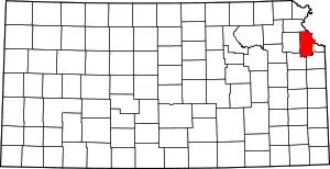 Map of Kansas highlighting Leavenworth County | |
| Unincorporated communities | ||
| Ghost town | ||
| Townships |
| |
| Footnotes | ‡This community also has portions in an adjacent county or counties. | |
This article is issued from Wikipedia. The text is licensed under Creative Commons - Attribution - Sharealike. Additional terms may apply for the media files.