| Si Phang Nga National Park | |
|---|---|
 | |
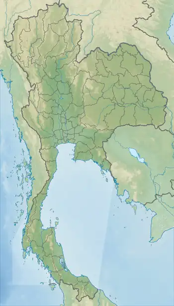
 Location in Thailand | |
| Location | Phang Nga Province, Thailand |
| Nearest city | Takua Pa |
| Coordinates | 9°08′53″N 98°28′19″E / 9.148°N 98.472°E[1] |
| Area | 246 km2 (95 sq mi) |
| Established | 16 Apr 1988 |
| Visitors | 21,251 (in 2019) |
| Governing body | Department of National Parks, Wildlife and Plant Conservation |
| Department of National Parks | |
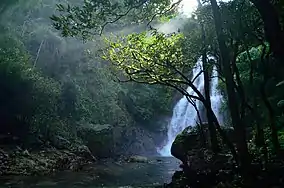
Si Phang Nga National Park (Thai: ศรีพังงา) is in Phang Nga Province in southern Thailand, covering the eastern parts of the districts Khura Buri and Takua Pa.
The landscape of the park is dominated by rugged mountains covered with dipterocarp forests, similar to the Khao Sok adjoining it to the east.
The establishment of the park was announced in the Royal Gazette, Issue 105, Chapter 60 of 16 April 1988.
The park occupies an area of 153,800 rai ~ 246 square kilometres (95 sq mi).[2]
See also
References
- ↑ "Si Phangnga". Protected Planet. Retrieved 28 October 2022.
- ↑ "ข้อมูลพื้นที่อุทยานแห่งชาติ ที่ประกาศในราชกิจจานุบกษา 133 แห่ง" [National Park Area Information published in the 133 Government Gazettes]. Department of National Parks, Wildlife and Plant Conservation (in Thai). December 2020. Retrieved 1 November 2022, no 56
{{cite web}}: CS1 maint: postscript (link)
External links
Wikimedia Commons has media related to Si Phangnga National Park.
This article is issued from Wikipedia. The text is licensed under Creative Commons - Attribution - Sharealike. Additional terms may apply for the media files.