Siddeburen | |
|---|---|
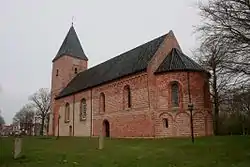
 Protestant Church in 2014 | |
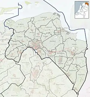
 Siddeburen Location of Siddeburen in the province of Groningen  Siddeburen Siddeburen (Netherlands) | |
| Coordinates: 53°14′55″N 6°51′52″E / 53.24861°N 6.86444°E | |
| Country | Netherlands |
| Province | Groningen |
| Municipality | Midden-Groningen |
| Area | |
| • Total | 22.04 km2 (8.51 sq mi) |
| Elevation | 1.1 m (3.6 ft) |
| Population (2021)[1] | |
| • Total | 3,205 |
| • Density | 150/km2 (380/sq mi) |
| Postal code | 9628[1] |
| Dialing code | 0598 |
Siddeburen (Dutch pronunciation: [sɪdəbyrən]; Gronings: Sibboeren or Siddeboeren) is a village in the Dutch province of Groningen. It is located in the municipality of Midden-Groningen, about 10 km southwest of Delfzijl.
Siddeburen was a separate municipality until 1826, when it was merged with Slochteren.[3]
History
The village was first mentioned in 1226 as "de Sigerdachurke", and means "settlement of Syerd (person)".[4] Siddeburen is a road village which developed on a sandy ridge in the late 12th century.[5] The village originally consisted of two parallel linear settlements.[6]
The Dutch Reformed church dates from around 1200. The tower was enlarged several times, but partially rebuilt and lowered in 1832.[5] The church was restored in the mid-20th century.[6]
Siddeburen was home to 1,335 people in 1840.[6]
References
- 1 2 3 "Kerncijfers wijken en buurten 2021". Central Bureau of Statistics. Retrieved 9 April 2022.
- ↑ "Postcodetool for 9628AA". Actueel Hoogtebestand Nederland (in Dutch). Het Waterschapshuis. Retrieved 9 April 2022.
- ↑ Ad van der Meer and Onno Boonstra, Repertorium van Nederlandse gemeenten, KNAW, 2011.
- ↑ "Siddeburen - (geografische naam)". Etymologiebank (in Dutch). Retrieved 9 April 2022.
- 1 2 Ronald Stenvert & Redmer Alma (1998). "Siddeburen" (in Dutch). Zwolle: Waanders. ISBN 90 400 9258 3. Retrieved 9 April 2022.
- 1 2 3 "Siddeburen". Plaatsengids (in Dutch). Retrieved 9 April 2022.
External links
 Media related to Siddeburen at Wikimedia Commons