| Siffleur River | |
|---|---|
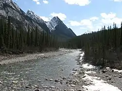
 The Siffleur River near its confluence with the North Saskatchewan River | |
| Location | |
| Country | Canada |
| Province | Alberta |
| Physical characteristics | |
| Source | |
| • location | Clearwater Pass |
| • coordinates | 51°42′19″N 116°16′35″W / 51.70528°N 116.27639°W |
| • elevation | 2,341 m (7,680 ft) |
| Mouth | |
• location | North Saskatchewan River |
• coordinates | 52°03′25″N 116°24′14″W / 52.05694°N 116.40389°W |
• elevation | 1,327 m (4,354 ft) |

The Siffleur River
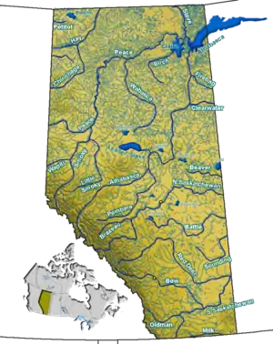
The Siffleur River is a short river rising in the Canadian Rockies in western Alberta. The Siffleur River is an early tributary of the North Saskatchewan River.
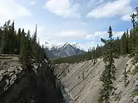
The river begins between Devon Mountain and Clearwater Mountain, at Clearwater Pass. The Siffleur is then joined by Dolomite Creek (flowing from Isabella Lake), and the Escarpment River. After plummeting over Siffleur Falls, the Siffleur River joins the North Saskatchewan River before Lake Abraham.[1]
Like the Siffleur Wilderness Area and Siffleur Mountain, the river's name was chosen by James Hector in 1858 for the shrill whistles of the marmot which inhabit the area.[2]
References
- ↑ Mussio Ventures. Southwestern Alberta Backroad Mapbook. Burnaby: Backroad Mapbooks (2004)
- ↑ "Siffleur Mountain". cdnrockiesdatabases.ca. Retrieved 2023-08-06.
See also
This article is issued from Wikipedia. The text is licensed under Creative Commons - Attribution - Sharealike. Additional terms may apply for the media files.
