.jpg.webp) Siliwangi Stadium | |
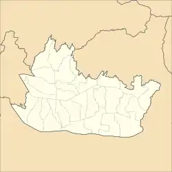
 Siliwangi Stadium Location in Bandung | |
| Full name | Siliwangi |
|---|---|
| Address | Jl. Lombok, Bandung, West Java Indonesia |
| Location | Bandung, West Java |
| Coordinates | 6°54′37″S 107°37′10″E / 6.910312°S 107.619367°E |
| Owner | Kodam III/Siliwangi |
| Operator | Kodam III/Siliwangi |
| Capacity | 25,000 |
| Surface | Artificial turf |
| Construction | |
| Built | 1 January 1954 |
| Opened | 1 January 1956 |
| Renovated | 1 January 1976 |
| Architect | Formatara Prima Sejati |
| Tenants | |
| Persib Bandung (1956–2013) Persib Bandung U-21 (1956–present) Persib Bandung U-19 (1956–present) Bandung Raya (1987–1997) PS TNI (2016) Bandung United (2019–present) PSKC Cimahi (2020–present) | |
Siliwangi Stadium or Stadion Siliwangi is a multi-purpose stadium in Bandung, Indonesia. It is currently used mostly for football matches. The stadium is owned by the Siliwangi Regional Military Commando (Komando Daerah Militer Siliwangi). The stadium holds 25,000.[1]
The Siliwangi Stadium was the former home base for Persib Bandung until the team left the venue in 2012, citing quality of the pitch, and the construction of the Si Jalak Harupat Soreang Stadium and Gelora Bandung Lautan Api Stadium.[2] The military-owned PS TNI played at the venue during the temporary Indonesia Soccer Championship league in 2016,[3] but the team only played two home matches there before moving to Pakansari Stadium due to the stadium being used as a cricket venue for the Pekan Olahraga Nasional.[4]
References
- ↑ "Stadion Sepakbola Indonesia: Stadion Siliwangi". 2008. Archived from the original on 2 December 2009.
- ↑ "PSSI Larang Persib & PBR Berkandang di Stadion Siliwangi" (in Indonesian). Archived from the original on 7 December 2013. Retrieved 13 October 2014.
- ↑ Adnan, Muhamad Rais. "Profil Klub Indonesia Soccer Championship A 2016: PS TNI | Goal.com". www.goal.com (in Indonesian). Archived from the original on 24 November 2017. Retrieved 2019-03-17.
- ↑ "PS TNI Pindah Markas Ke Stadion Pakansari Bogor" (in Indonesian). Archived from the original on 20 October 2016. Retrieved 17 May 2016.
6°54′37″S 107°37′10″E / 6.910312°S 107.619367°E