Sinapali | |
|---|---|
Village/Town | |
 Sinapali Location in Odisha, India  Sinapali Sinapali (India) | |
| Coordinates: 20°05′51″N 82°38′46″E / 20.0974°N 82.646°E | |
| Country | India |
| State | Odisha |
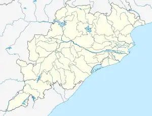
| District | Nuapada |
| Government | |
| • Body | Gram Panchayat Samiti |
| • MLA | Adhiraj Mohan Panigrahi |
| • MP | Basanta Kumar Panda |
| Population (2001) | |
| • Total | 9,987 |
| Demonym | Sinapalia |
| Languages | |
| • Official | Odia |
| • Local | Kalahandi |
| Time zone | UTC+5:30 (IST) |
| PIN | 766108 |
| Telephone code | 06677 |
| Vehicle registration | OD, OR |
| Sex ratio | 50.3:49.7 ♂/♀ |
| Website | odisha |
Sinapali is the main town in Sinapali Tehsil in the south of Nuapada District in Odisha, India.
It is located on the bank of Udanti River, 95 kilometres (59 mi) south of the district headquarters of Nuapada (via road NH59) and 450 km (280 mi) from Odisha's capital Bhubaneswar. The village has a Gram panchayat (local governing council). Its total geographical area is 297 hectares (730 acres).
Administration
Sinapali is a Panchayat Samiti(Block) and Tahasil[1] in Nuapada District of Odisha. Administrative head of the block is Block Development Officer (BDO). There are many block level offices are located. Some of them are as follows:-
- Tahasil Office[2]
- Block Education Office
- Police Station
- Fire Station
- Community Health Center
- Regional Agriculture Office
Government
Sinapali Panchayat Samiti have a Chairman in its Block level.
Gram Panchayat
There are 27 Gram Panchyats.[3]
Demographics
According to the 2011 Census of India,[4] Sinapali had the following population characteristics:
| Number of households | 1,315 |
| Total population | 5,069 |
| Total males | 2,769 |
| Total females | 2,553 |
| Total SC population | 536 |
| Total ST population | 353 |
| Literacy rate | 75.81% |
| Worker population | 1,553 |
Males make up 50.3% of Sinapali's population, whereas 49.7% of the population is female.
The main languages spoken in the Sinpali and Nuapada districts are Sambalpuri, Laria. Odia and English is used in schools in Odisha for higher education.
Economy
Sinapali's economy, like the rest of the Nuapada district, depends mainly upon its agricultural and forestry activities. Locals produce non-timber forest products such as the mahua flower, harida, bahada, and tol. Local agriculture is challenging due to limited irrigation facilities (less than 15%, only half of the state average).[5]
References
- ↑ https://nuapada.nic.in/tahasil-sinapali-village-list/
- ↑ https://nuapada.nic.in/directory/tahasil-office-sinapali/
- ↑ https://rdcsdbmp.nic.in/nuapada-district-grampanchayat/
- ↑ "Sinapali Population – Nuapada, Orissa" (PDF). Retrieved 29 April 2020. "Sinapali-orissa on census2011-co-in
- ↑ "Nuapada Economy". Retrieved 30 April 2020.