Zwalm | |
|---|---|
 | |
 Flag  Coat of arms | |
Location of Zwalm | |
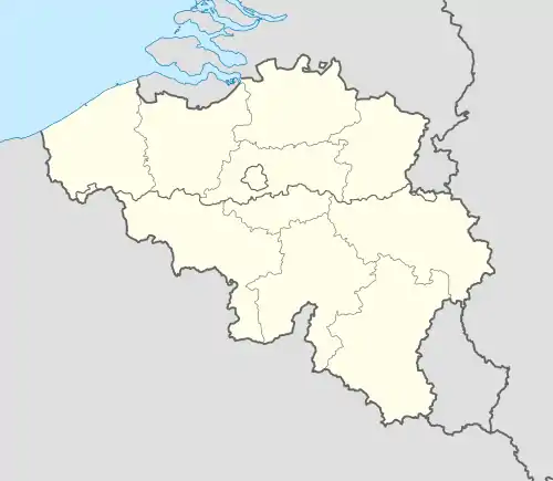 Zwalm Location in Belgium
Location of Zwalm in East Flanders  | |
| Coordinates: 50°53′N 03°44′E / 50.883°N 3.733°E | |
| Country | |
| Community | Flemish Community |
| Region | Flemish Region |
| Province | East Flanders |
| Arrondissement | Oudenaarde |
| Government | |
| • Mayor | Bruno Tuybens (VoorZwalm) |
| • Governing party/ies | VoorZwalm, CD&V-Plus, N-VA |
| Area | |
| • Total | 33.88 km2 (13.08 sq mi) |
| Population (2018-01-01)[1] | |
| • Total | 8,134 |
| • Density | 240/km2 (620/sq mi) |
| Postal codes | 9630, 9636 |
| NIS code | 45065 |
| Area codes | 055, 09 |
| Website | www.zwalm.be |
Zwalm (Dutch pronunciation: [ˈzʋɑl(ə)m] ⓘ) is a municipality located in Flanders, in the Flemish province of East Flanders, in Belgium. The municipality comprises the villages of Beerlegem, Dikkele, Hermelgem, Hundelgem, Meilegem, Munkzwalm, Nederzwalm, Paulatem, Roborst, Rozebeke, Sint-Blasius-Boekel, Sint-Denijs-Boekel and Sint-Maria-Latem. In 2021, Zwalm had a total population of 8,244. The total area is 33.82 km2.[2]
Gallery
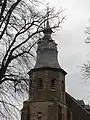 Church of Roborst
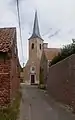 Hundelgem, church: Sint-Amanduskerk
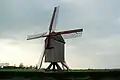 Vinkemolen Wind Mill in Franskouter, Sint-Denijs-Boekel
 Water mill in Nederzwalm
References
- ↑ "Wettelijke Bevolking per gemeente op 1 januari 2018". Statbel. Retrieved 9 March 2019.
- ↑ "Bevolking per statistische sector - Sector 45065". Statistics Belgium. Retrieved 8 May 2022.
External links
 Media related to Zwalm at Wikimedia Commons
- Official website (in Dutch)
| Aalst |  | |
|---|---|---|
| Dendermonde | ||
| Eeklo | ||
| Ghent | ||
| Oudenaarde | ||
| Sint-Niklaas | ||
| ||
This article is issued from Wikipedia. The text is licensed under Creative Commons - Attribution - Sharealike. Additional terms may apply for the media files.