Sitkum, Oregon | |
|---|---|
.jpg.webp) Civilian Conservation Corps' Camp Sitkum, 1933 | |
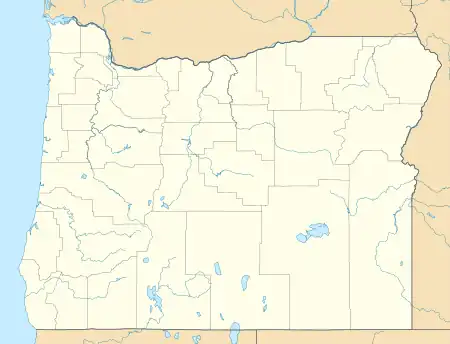 Sitkum Location within the state of Oregon  Sitkum Sitkum (the United States) | |
| Coordinates: 43°08′53″N 123°51′40″W / 43.14806°N 123.86111°W | |
| Country | United States |
| State | Oregon |
| County | Coos |
| Elevation | 722 ft (220 m) |
| Time zone | UTC-8 (Pacific (PST)) |
| • Summer (DST) | UTC-7 (PDT) |
Sitkum is an unincorporated community in Coos County, Oregon, United States.[1] It is about 27 miles north of Remote in the Southern Oregon Coast Range near the East Fork Coquille River.[2] Sitkum is served by the Myrtle Point post office.
A tavern or roadhouse was established as a stagecoach stop near a point halfway between Roseburg and Coos City on the Coos Bay Wagon Road about 1872 or 1873.[3][4] A competitor put up another halfway house nearby and the name Sitkum, a Chinook Jargon word for "half", was selected for the place.[3] Sitkum post office took its name from the tavern.[3] It ran from 1873 to 1964, with one intermission.[3] The Halfway House at Sitkum was a combination restaurant, tavern, rooming house, post office and telegraph station where travelers stopped while horses were changed.[4] There is little left of the community today, and the Sitkum School was converted into a residence.[4] The former teacher's house and the gym still exist on the grounds.[4]
Google Maps cartographic team did not bother to record the town, and the site's map "pin" locates the town center out in a pasture.
Climate
Sitkum has a Köppen climate type of CSB (warm-summer mediterranean), which is most of western Oregon.
| Climate data for Sitkum, Oregon 1948-1969 | |||||||||||||
|---|---|---|---|---|---|---|---|---|---|---|---|---|---|
| Month | Jan | Feb | Mar | Apr | May | Jun | Jul | Aug | Sep | Oct | Nov | Dec | Year |
| Mean daily maximum °F (°C) | 47.7 (8.7) |
52.6 (11.4) |
54.5 (12.5) |
60.7 (15.9) |
65.8 (18.8) |
71.9 (22.2) |
77.1 (25.1) |
77.8 (25.4) |
74.3 (23.5) |
65 (18) |
55.6 (13.1) |
50.2 (10.1) |
62.8 (17.1) |
| Mean daily minimum °F (°C) | 34.0 (1.1) |
36.5 (2.5) |
36.5 (2.5) |
38.7 (3.7) |
43.0 (6.1) |
47.0 (8.3) |
49.2 (9.6) |
49.7 (9.8) |
47.5 (8.6) |
43.7 (6.5) |
39.3 (4.1) |
36.4 (2.4) |
41.8 (5.4) |
| Average precipitation inches (mm) | 12.86 (327) |
11 (280) |
11.0 (280) |
4.46 (113) |
4.18 (106) |
1.71 (43) |
0.46 (12) |
0.8 (20) |
2.04 (52) |
7.28 (185) |
11.08 (281) |
13.17 (335) |
80.03 (2,033) |
| Average snowfall inches (cm) | 5.3 (13) |
2.4 (6.1) |
2.2 (5.6) |
0.6 (1.5) |
0.3 (0.76) |
0 (0) |
0 (0) |
0 (0) |
0 (0) |
0.0 (0.0) |
1.3 (3.3) |
1.1 (2.8) |
13.2 (34) |
| Source: https://wrcc.dri.edu/ | |||||||||||||
References
- 1 2 "Sitkum". Geographic Names Information System. United States Geological Survey, United States Department of the Interior. November 28, 1980. Retrieved January 11, 2011.
- ↑ Oregon Atlas & Gazetteer (7th ed.). Yarmouth, Maine: DeLorme. 2008. p. 52. ISBN 0-89933-347-8.
- 1 2 3 4 McArthur, Lewis A.; McArthur, Lewis L. (2003) [1928]. Oregon Geographic Names (7th ed.). Portland, Oregon: Oregon Historical Society Press. p. 883. ISBN 978-0875952772.
- 1 2 3 4 Friedman, Ralph (1990). In Search of Western Oregon (2nd ed.). Caldwell, Idaho: The Caxton Printers, Ltd. pp. 225–226. ISBN 0-87004-332-3.
External links
- Historic image of Civilian Conservation Corps camp in Sitkum from the Oregon State University Archives
Municipalities and communities of Coos County, Oregon, United States | ||
|---|---|---|
| Cities |  Coos County map | |
| CDPs | ||
| Other communities | ||
| Ghost town | ||
| Indian reservations | ||
| Footnotes | ‡This populated place also has portions in an adjacent county or counties | |