Slovenská Ves | |
|---|---|
Village | |
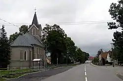 View on the main street | |
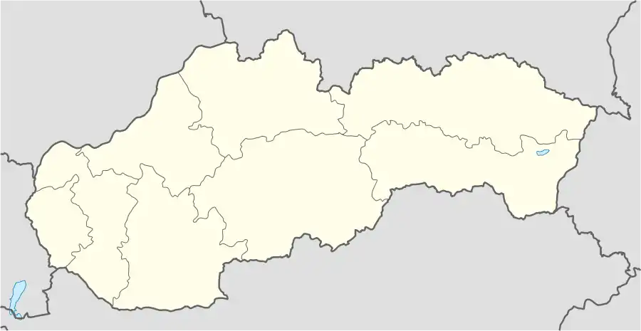 Slovenská Ves Location in Slovakia | |
| Coordinates: 49°13′30″N 20°25′30″E / 49.22500°N 20.42500°E | |
| Country | Slovakia |
| Region | Prešov |
| District | Kežmarok |
| First mentioned | 1311 |
| Area | |
| • Total | 22.42[1] km2 (8.66[1] sq mi) |
| Elevation | 647[2] m (2,123[2] ft) |
| Population (2021) | |
| • Total | 1,883[3] |
| Time zone | UTC+1 (CET) |
| • Summer (DST) | UTC+2 (CEST) |
| Postal code | 059 02[2] |
| Area code | +421 52[2] |
| Website | http://slovenskaves.info |
Slovenská Ves (Hungarian: Szepestótfalu and Hungarian: Tótfalu; German: Windschendorf) is a village and municipality in Kežmarok District in the Prešov Region of north Slovakia.
Geography
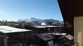
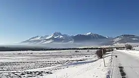
The municipality lies at an altitude of 650 metres and covers an area of 22.4 km2. It has a population of 1862 inhabitants.[4] It is located under the largest mountain in middle Europe called the Tatras, surrounded by lush forests, with a lot of natural wells, rich in mushrooms and berries, being as a living space for wild animals as a bear, deer or fox.
History
In historical records, the village was first mentioned in 1311. It had been also known under the name Windschendorf.[5]
The main employment of the village population since its establishment was agricultural manufacture. The main crops were and still are wheat and potatoes. Because of large meadows on mountain roots, a sheep breeding was the next favorite activity.
Economy and infrastructure
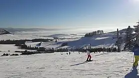

In the village there are several sport clubs, like table tennis, or football. In Slovenská Ves there is also a ski lift and a gym hall. Gothic Roman Catholic church and a classistic manor house are the most important cultural attractions for sightseeing.
Near the village is located a Jewish cemetery which was being built before the second world war. It was restored few years ago and now serves as a worth memory for the next generations.
The area of the village location is called Spiš which isn't very densely populated. This is a big advantage for people enjoying free space and fresh air. The closest bigger city (population ↑15k) is 12 km far away, the village is a crossroad to the Tatras and to Poland.
References
- 1 2 "Hustota obyvateľstva - obce [om7014rr_ukaz: Rozloha (Štvorcový meter)]". www.statistics.sk (in Slovak). Statistical Office of the Slovak Republic. 2022-03-31. Retrieved 2022-03-31.
- 1 2 3 4 "Základná charakteristika". www.statistics.sk (in Slovak). Statistical Office of the Slovak Republic. 2015-04-17. Retrieved 2022-03-31.
- ↑ "Počet obyvateľov podľa pohlavia - obce (ročne)". www.statistics.sk (in Slovak). Statistical Office of the Slovak Republic. 2022-03-31. Retrieved 2022-03-31.
- ↑ "Statistical Office of the Slovak Republic" (PDF). Tab. 1 Obyvateľstvo trvalo bývajúce v obciach SR podľa veku a pohlavia, SODB 2011. Retrieved 11 August 2012.
- ↑ "E-obce.sk Slovensko". Slovenská Ves, Základné údaje. Retrieved 11 August 2012.
External links
- http://www.slovenskaves.sk Official homepage (in Slovak)
- Article about church in Slovenská Ves (in Slovak)
- Video about the village
- Weather in Slovenská Ves (in Slovak)