| Smotrych Ukrainian: Смотрич | |
|---|---|
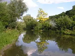
 The Smotrych River seen near the historic city of Kamianets-Podilskyi, Ukraine. | |
  | |
| Location | |
| Country | Ukraine |
| Oblast | Khmelnytskyi Oblast |
| City | Kamianets-Podilskyi |
| Physical characteristics | |
| Mouth | |
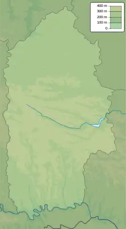
• coordinates | 48°33′51″N 26°38′16″E / 48.5642°N 26.6378°E |
| Length | 168 km (104 mi) |
| Basin size | 1,800 km2 (690 sq mi) |
| Basin features | |
| Progression | Dniester→ Dniester Estuary→ Black Sea |
| Designation | |
| Official name | Lower Smotrych River |
| Designated | 29 July 2004 |
| Reference no. | 1401[1] |
The Smotrych (Ukrainian: Смотрич, Polish: Smotrycz) is a left tributary of the Dniester, flowing through the Podillia upland of western Ukraine. Its length is 168 km (104 mi), and its drainage basin covers 1,800 km2 (694 mi2).[2] The average width of the river is 10–15 meters wide, and at one point exceeds 40 m.
The river is particularly notable for its tall banks, which give it a ravinelike appearance. It is used for water supply, irrigation, and fishing. A small hydroelectric station is situated on it, as well as the city of Kamianets-Podilskyi, the urban-type settlement Smotrych and the town of Horodok (Khmelnytskyi Oblast).
References
- ↑ "Lower Smotrych River". Ramsar Sites Information Service. Retrieved 25 April 2018.
- ↑ Смотрич (река), Great Soviet Encyclopedia
This article is issued from Wikipedia. The text is licensed under Creative Commons - Attribution - Sharealike. Additional terms may apply for the media files.