Solodke
Солодке | |
|---|---|
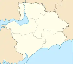
 Solodke Location of Solodke in Zaporizhzhia Oblast  Solodke Solodke (Ukraine) | |
| Coordinates: 47°47′09″N 36°19′13″E / 47.78583°N 36.32028°E | |
| Country | |
| Province | Zaporizhzhia Oblast |
| District | Polohy Raion |
| Hromada | Huliaipole urban hromada |
| Founded | 1932 |
| Area | |
| • Total | 1.265 km2 (0.488 sq mi) |
| Elevation | 133 m (436 ft) |
| Population (2001) | |
| • Total | 139 |
| • Density | 110/km2 (280/sq mi) |
| Time zone | UTC+2 (EET) |
| • Summer (DST) | UTC+3 (EEST) |
| Postal code | 70214 |
| Area code | +380 6145 |
| Climate | Dfa |
Solodke (Ukrainian: Солодке) is a village (a selo) in the Polohy Raion (district) of Zaporizhzhia Oblast in southern Ukraine. It is part of Huliaipole urban hromada, one of the hromadas of Ukraine.
Until 18 July 2020, Solodke belonged to Huliaipole Raion. The raion was abolished in July 2020 as part of the administrative reform of Ukraine, which reduced the number of raions of Zaporizhzhia Oblast to five. The area of Huliaipole Raion was merged into Polohy Raion.[2][3]
Demographics
Native language as of the Ukrainian Census of 2001:[4]
| Language | Percentage |
|---|---|
| Ukrainian | 92.09 % |
| Armenian | 6.47 % |
| Russian | 1.44 % |
References
- ↑ "Solodke (Zaporizhzhia Oblast, Polohy Raion)". weather.in.ua. Retrieved 3 August 2023.
- ↑ "Про утворення та ліквідацію районів. Постанова Верховної Ради України № 807-ІХ". Голос України (in Ukrainian). 18 July 2020. Retrieved 3 October 2020.
- ↑ "Нові райони: карти + склад" (in Ukrainian). Міністерство розвитку громад та територій України.
- ↑ Розподіл населення за рідною мовою на ukrcensus.gov.ua Archived 31 July 2014 at the Wayback Machine
This article is issued from Wikipedia. The text is licensed under Creative Commons - Attribution - Sharealike. Additional terms may apply for the media files.