Sombacour | |
|---|---|
Part of Val-d'Usiers | |
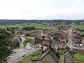
 A general view of Sombacour | |
.svg.png.webp) Coat of arms | |
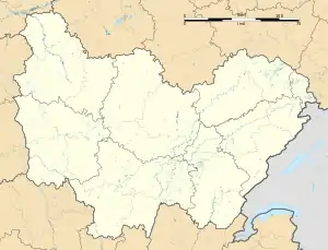
Location of Sombacour | |
 Sombacour  Sombacour | |
| Coordinates: 46°57′15″N 6°15′28″E / 46.9542°N 6.2578°E | |
| Country | France |
| Region | Bourgogne-Franche-Comté |
| Department | Doubs |
| Arrondissement | Pontarlier |
| Canton | Ornans |
| Commune | Val-d'Usiers |
| Area 1 | 19.3 km2 (7.5 sq mi) |
| Population (2021)[1] | 629 |
| • Density | 33/km2 (84/sq mi) |
| Time zone | UTC+01:00 (CET) |
| • Summer (DST) | UTC+02:00 (CEST) |
| Postal code | 25520 |
| Elevation | 715–907 m (2,346–2,976 ft) |
| 1 French Land Register data, which excludes lakes, ponds, glaciers > 1 km2 (0.386 sq mi or 247 acres) and river estuaries. | |
Sombacour (French pronunciation: [sɔ̃bakuʁ]) is a former commune in the Doubs department in the Bourgogne-Franche-Comté region in eastern France. It merged with Bians-les-Usiers and Goux-les-Usiers to form the new commune of Val-d'Usiers on 1 January 2024.[2]
Geography
Sombacour lies 12 km (7.5 mi) northeast of Levier.
Population
| Year | Pop. | ±% p.a. |
|---|---|---|
| 1968 | 463 | — |
| 1975 | 464 | +0.03% |
| 1982 | 512 | +1.42% |
| 1990 | 514 | +0.05% |
| 1999 | 524 | +0.21% |
| 2009 | 588 | +1.16% |
| 2014 | 615 | +0.90% |
| 2020 | 632 | +0.46% |
| Source: INSEE[3] | ||
See also
References
- ↑ "Populations légales 2021" [Legal populations 2021] (PDF) (in French). INSEE. December 2023.
- ↑ "Recueil des actes administratifs n°25-2023-136 du département du Doubs publié le 27 septembre 2023" (pdf).
- ↑ Population en historique depuis 1968, INSEE
External links
Wikimedia Commons has media related to Sombacour.
- Sombacour on the regional Web site (in French)
This article is issued from Wikipedia. The text is licensed under Creative Commons - Attribution - Sharealike. Additional terms may apply for the media files.