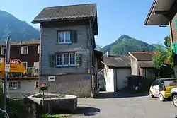
Sool | |
|---|---|
Village (and former municipality) | |
 | |
 Coat of arms | |
 The former municipal area (2007) | |
| Coordinates: 47°0′N 9°5′E / 47.000°N 9.083°E | |
| Country | Switzerland |
| Canton | Glarus |
| Municipality | Glarus Süd |
| Area | |
| • Total | 13.26 km2 (5.12 sq mi) |
| Elevation | 637 m (2,090 ft) |
| Population (December 2020) | |
| • Total | 296 |
| • Density | 22/km2 (58/sq mi) |
Sool is a village, and former municipality, in the municipality of Glarus Süd and canton of Glarus in Switzerland.[1][2]
History
Sool is first mentioned between 1303-07 as soler tagwan.[2]
On 1 January 2011, Sool became part of the new municipality of Glarus Süd.[3]
Geography
The village of Sool is situated at an elevation of 637 m (2,090 ft) on a prehistoric landslide, between the valleys of the Linth and Sernf rivers. The village of Schwanden lies below it, at the confluence of both rivers.[1][2]
Sool has an area, as defined by the former municipal boundaries in 2006, of 13.3 km2 (5.1 sq mi), covering a considerable area to the north and east of the village. This area reaches up to the peak of the Gufelstock (2,436 m or 7,992 ft). Of this area, 23.6% is used for agricultural purposes, while 42% is forested. Of the rest of the land, 1.2% is settled (buildings or roads) and the remainder (33.2%) is non-productive (rivers, glaciers or mountains).[1][4]
Transport
The Sernftalbus operates a bus service linking Sool with Schwanden railway station, with several return journeys a day. At Schwanden railway station, a connecting railway service runs to the capital of the canton of Glarus, the town of Glarus.[5]
Demographics
Sool has a population (as of 31 December 2020) of 296.[6] As of 2007, 3.5% of the population was made up of foreign nationals.[7] Over the last 10 years the population has grown at a rate of 2.1%. Most of the population (as of 2000) speaks German (98.0%), with Russian being second most common ( 1.0%) and Rhaeto-Romance being third ( 0.3%).[4]
In the 2007 federal election the most popular party was the SPS which received 80% of the vote. Most of the rest of the votes went to the SVP with 14.4% of the vote.[4]
In Sool about 72.9% of the population (between age 25-64) have completed either non-mandatory upper secondary education or additional higher education (either University or a Fachhochschule).[4]
Sool has an unemployment rate of 1.5%. As of 2005, there were 15 people employed in the primary economic sector and about 9 businesses involved in this sector. 8 people are employed in the secondary sector and there are 2 businesses in this sector. 10 people are employed in the tertiary sector, with 4 businesses in this sector.[4]
References
- 1 2 3 map.geo.admin.ch (Map). Swiss Confederation. Retrieved 1 June 2015.
- 1 2 3 "Sool". Historical Dictionary of Switzerland (in French). 30 July 2014. Retrieved 2 June 2015.
- ↑ "Gemeinde Glarus Süd" [Glarus Süd Municipality] (in German). Gemeinde Glarus Süd. Retrieved 29 May 2015.
- 1 2 3 4 5 Swiss Federal Statistical Office Archived 2011-09-04 at the Wayback Machine accessed 14-Sep-2009
- ↑ "Sernftalbus - Fahrplan 2015" [Sernftalbus - Timetable 2015] (PDF) (in German). Autobetrieb Sernftal AG. Archived from the original (PDF) on 2015-04-27. Retrieved 2015-04-20.
- ↑ "Ständige und nichtständige Wohnbevölkerung nach institutionellen Gliederungen, Geburtsort und Staatsangehörigkeit". bfs.admin.ch (in German). Swiss Federal Statistical Office - STAT-TAB. 31 December 2020. Retrieved 21 September 2021.
- ↑ Canton Glarus population growth (in German) accessed 9 September 2009
External links
 Media related to Sool at Wikimedia Commons
- Sool from the Glarus Süd municipal web site (in German)
- Sool in German, French and Italian in the online Historical Dictionary of Switzerland.