South Ayrshire Sooth Ayrshire Siorrachd Àir a Deas | |
|---|---|
 | |
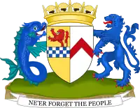 Coat of arms  Council logo | |
| Coordinates: 55°17′N 4°42′W / 55.283°N 4.700°W | |
| Sovereign state | United Kingdom |
| Constituent country | Scotland |
| Lieutenancy area | Ayrshire and Arran |
| Administrative headquarters | Ayr |
| Government | |
| • Body | South Ayrshire Council |
| • Control | Conservative (council NOC) |
| • MPs |
|
| • MSPs |
|
| Area | |
| • Total | 472 sq mi (1,222 km2) |
| • Rank | Ranked 15th |
| Population (2021) | |
| • Total | 112,450 |
| • Rank | Ranked 19th |
| • Density | 240/sq mi (92/km2) |
| ONS code | S12000028 |
| ISO 3166 code | GB-SAY |
| Website | www |
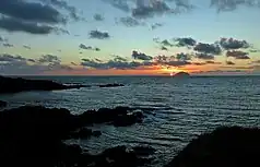
South Ayrshire (Scots: Sooth Ayrshire; Scottish Gaelic: Siorrachd Àir a Deas, pronounced [ˈʃirˠəxk aːɾʲ ə ˈtʲes̪]) is one of thirty-two council areas of Scotland, covering the southern part of Ayrshire. It borders onto Dumfries and Galloway, East Ayrshire and North Ayrshire. The area had an estimated population in 2021 of 112,450.[1]
History
South Ayrshire was created in 1996 under the Local Government etc. (Scotland) Act 1994, which replaced Scotland's previous local government structure of upper-tier regions and lower-tier districts with unitary council areas providing all local government services. South Ayrshire covered the same area as the abolished Kyle and Carrick district, and also took over the functions of the abolished Strathclyde Regional Council within the area.[2] The area's name references its location within the historic county of Ayrshire, which had been abolished for local government purposes in 1975 when Kyle and Carrick district and Strathclyde region had been created.[3]
In 2021, South Ayrshire submitted a bid for city status as part of the 2022 Platinum Jubilee Celebrations. The bid was based on the area's rich history and links to royalty, and received backing from organisations and businesses including Ayrshire College and Scottish Enterprise.[4] The bid was ultimately unsuccessful, with eight other settlements across the UK, overseas territories and crown dependencies being awarded city status, including Scottish town Dunfermline.[5]
Geography
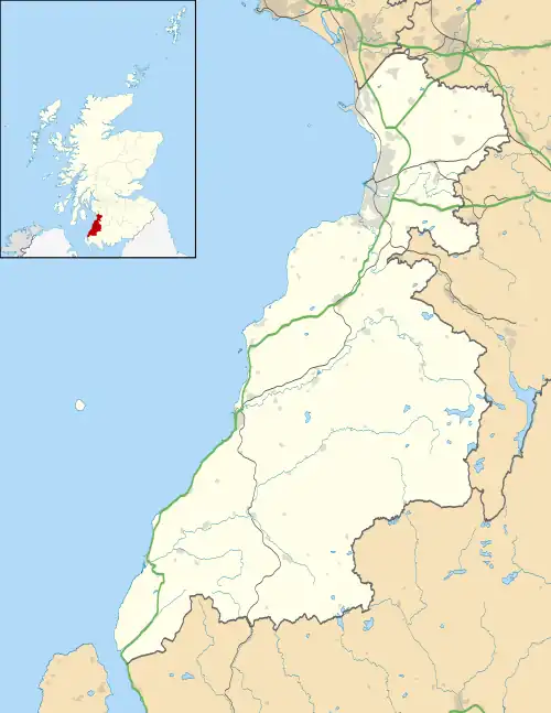
Geographically, South Ayrshire is located on the western coast of Scotland, sharing borders with neighbouring local authorities East Ayrshire, Dumfries and Galloway and North Ayrshire. The climate in South Ayrshire, typical of that in western Scotland, is milder than that of eastern Scotland due to the stronger maritime influence, as the prevailing winds blow from the sea into South Ayrshire, which is located primarily on the western coast of Scotland. The warm Gulf Stream also has a strong influence on western Scotland. With winds mainly blowing from the sea the annual mean temperatures are in the range 9.5 to 9.9 °C (49.1 to 49.8 °F) in coastal areas of South Ayrshire such as Ayr and Troon.
The sea reaches its lowest temperature in February or early March so that on average February is the coldest month in some coastal parts of South Ayrshire along with the Rhins of Galloway, Kintyre and the Hebrides. In February the mean daily minimum temperature varies from about 2 °C in most of the islands, 1 to 2 °C along most of the Solway Firth and lowland inland areas, but less than −1 °C in parts of the Southern Uplands and central Highlands. Inland, where the influence of the sea is less, January is the coldest month with mean daily minimum temperatures generally between −3 and 0 °C.[6]
The number of hours of natural sunshine in South Ayrshire is controlled by the length of day and by cloudiness. In general, December is the dullest month and May or June the sunniest. Sunshine duration decreases with increasing altitude, increasing latitude and distance from the coast. Local topography also exerts a strong influence and in the winter deep glens and north-facing slopes can be in shade for long periods. Industrial pollution and smoke haze can also reduce sunshine amounts, but the decline in heavy industry in the Ayrshire area, primarily in Ayr in South Ayrshire along with Kilmarnock in East Ayrshire, has resulted in an increase in sunshine duration particularly in the winter months.[6]
Average annual rainfall totals range from less than 1,000 mm (39 in) in the upper Clyde valley and along the coasts of Ayrshire and Dumfries and Galloway to on average over 3,500 mm (140 in) over the higher parts of the west Highlands, approaching the maximum values found in the UK (over 4,000 millimetres or 160 inches further north).[6]
Settlements
.jpg.webp)
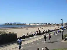
South Ayrshire's population is mostly concentrated around the adjoining coastal towns of Ayr, Prestwick and Troon located to the north-west of the council, which represents 68% of the council's total population according to data derived from the 2011 census, with a combined population of 76,846. Other areas of significance include the towns of Maybole and Girvan which are located to the south of the council area in the district of Carrick.
Largest settlements by population:
| Settlement | Population (mid-2020 est.)[7] |
|---|---|
| Ayr |
46,260 |
| Troon |
14,950 |
| Prestwick |
14,880 |
| Girvan |
6,330 |
| Maybole |
4,580 |
| Dundonald |
2,570 |
| Coylton |
2,160 |
| Mossblown |
2,100 |
| Tarbolton |
1,860 |
| Symington |
1,510 |
A list of settlements in South Ayrshire may be found below:
Towns
Villages and hamlets
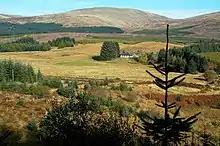
- Alloway (Suburb of Ayr)
- Annbank
- Ballantrae
- Barassie (Suburb of Troon)
- Barr
- Barrhill
- Colmonell
- Coodham
- Coylton
- Craigie
- Crosshill
- Dailly
- Dundonald
- Dunure
- Failford[8]
- Joppa (Suburb of Coylton)
- Kirkmichael
- Kirkoswald
- Lendalfoot
- Loans
- Maidens
- Monkton
- Mossblown
- Minishant
- Old Dailly
- Pinmore
- Pinwherry
- Straiton
- Symington
- Tarbolton
- Turnberry
Places of interest

- Ailsa Craig
- Bachelor's Club, Tarbolton
- Bargany Gardens
- Blairquhan
- Burns Cottage
- Robert Burns Birthplace Museum (Robert Burns)
- Carrick Forest
- Crossraguel Abbey
- Culzean Castle
- Electric Brae
- Penkill Castle
- Souter Johnnie's Cottage
- Royal Troon Golf Club
- Turnberry Hotel and Golf Course
Economy
The economy of South Ayrshire, like many other areas, was badly affected during the worldwide financial crisis from 2009–2012. Despite this, total Gross Value Added for South Ayrshire has seen a steady increase over the last 20 years, reaching a peak in 2015 of £2.4 million. South Ayrshire's GVA represents 1.9% of the total Scottish Gross Value Added income which is consistent with the previous 20 years. The largest employment industry in South Ayrshire and Scotland is the public administration, education and health sector. Compared with Scotland, proportionally there are more South Ayrshire residents employed in this sector than Scotland, while there are proportionally fewer employed in banking, finance and insurance sector than Scotland. Despite being a costal area, the smallest employment in South Ayrshire is in the agriculture and fishing sector.[9]
The council and its neighbours of East Ayrshire and North Ayrshire work together on economic growth as the Ayrshire Regional Economic Partnership, with support from the Scottish and UK governments and other private and public sector organisations.[10]
Education
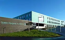
Educational provision in South Ayrshire is offered via eight secondary schools, forty-one primary schools, two special needs schools and five stand-alone Early Years Centres (although some primary schools have Early Years Centres attached).[11][12] In terms of early years provision, there are also a number of private establishments which are operated in conjunction with South Ayrshire Council, rather than managed and operated entirely by the council.[12] Based on figures from the 2016-2017 academic year, within South Ayrshire, there were 6,091 secondary school aged pupils,[13] 7,855 primary school aged pupils[13] and 251 pupils attending special educational needs provision establishments.[13]
Governance
South Ayrshire Council | |
|---|---|
 | |
| Leadership | |
Eileen Howat since May 2013[14] | |
| Structure | |
| Seats | 28 councillors |
11 / 28 | |
7 / 28 | |
5 / 28 | |
4 / 28
| |
1 / 28
| |
| Elections | |
| Single transferable vote | |
Last election | 6 May 2022 |
Next election | 6 May 2027 |
| Meeting place | |
 | |
| County Buildings, Wellington Square, Ayr, KA7 1DR | |
| Website | |
| www | |
The council has been under no overall control since 2003, in which time various coalitions and minority administrations have operated. Since the last election in 2022, the council has been led by a Conservative minority administration which took office with support from two independent councillors and abstentions from Labour.[15] The next election is due in 2027.
The council's civic head takes the title of provost. This is a largely ceremonial role, chairing council meetings and acting as the area's first citizen. Although an elected councillor, the provost is expected to be politically impartial.[16] Political leadership is provided by the leader of the council.
Political control
The first election to South Ayrshire Council was held in 1995, initially operating as a shadow authority alongside the outgoing authorities until the new system came into force on 1 April 1996. Political control of the council since 1996 has been as follows:[17]
| Party in control | Years | |
|---|---|---|
| Labour | 1996–2003 | |
| No overall control | 2003– | |
Leadership
The leaders of the council since 1996 have been:[18][19]
| Councillor | Party | From | To | |
|---|---|---|---|---|
| Ian Welsh[20] | Labour | 1 Apr 1996 | 6 May 1999 | |
| John Baillie | Labour | 20 May 1999 | Jun 2000 | |
| Andy Hill | Labour | 22 Jun 2000 | Nov 2005 | |
| Gibson MacDonald | Conservative | 15 Dec 2005 | May 2007 | |
| Hugh Hunter | Conservative | 2007 | Jan 2010 | |
| Bill McIntosh | Conservative | 3 Feb 2010 | May 2017 | |
| Douglas Campbell | SNP | 18 May 2017 | Jun 2020 | |
| Peter Henderson | SNP | 25 Jun 2020 | May 2022 | |
| Martin Dowey | Conservative | 19 May 2022 | ||
Elections
Since 2007 elections have been held every five years under the single transferable vote system, introduced by the Local Governance (Scotland) Act 2004. Election results since 1995 have been as follows:[17]
| Year | Seats | Conservative | SNP | Labour | Independent / Other | Notes |
|---|---|---|---|---|---|---|
| 1995 | 25 | 4 | 0 | 21 | 0 | Labour majority |
| 1999 | 30 | 13 | 0 | 17 | 0 | New ward boundaries.[21] Labour majority |
| 2003 | 30 | 15 | 0 | 15 | 0 | |
| 2007 | 30 | 12 | 8 | 9 | 1 | New ward boundaries.[22] |
| 2012 | 30 | 10 | 9 | 9 | 2 | |
| 2017 | 28 | 12 | 9 | 5 | 2 | New ward boundaries.[23] |
| 2022 | 28 | 10 | 9 | 5 | 4 | |
Premises
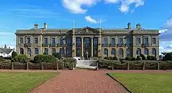
The council is based at County Buildings on Wellington Square in Ayr, which had been built in 1931 as the headquarters for the old Ayrshire County Council, being an extension to the older Sheriff Court built in 1818.[24][25] When South Ayrshire Council was created in 1996 it inherited the former Kyle and Carrick District Council's offices at Burns House on Burns Statue Square in Ayr as well as County Buildings, the latter having been used between 1975 and 1996 as an area office for Strathclyde Regional Council.[26] In 2019 the council consolidated its offices into County Buildings. Burns House was subsequently demolished in 2021, creating a new open space, landscaped with funding from the Scottish Government.[27]
Wards
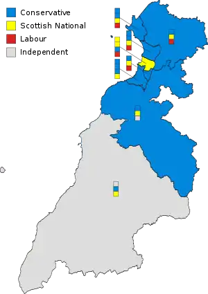
Since 2017 the area has been divided into eight wards, all electing either three or four councillors:[23]
| Ward Number |
Ward Name | Location | Seats |
|---|---|---|---|
| 1 | Troon | 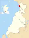 |
4 |
| 2 | Prestwick | 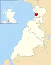 |
4 |
| 3 | Ayr North |  |
4 |
| 4 | Ayr East |  |
3 |
| 5 | Ayr West |  |
4 |
| 6 | Kyle | 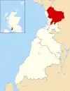 |
3 |
| 7 | Maybole, North Carrick and Coylton |  |
3 |
| 8 | Girvan and South Carrick |  |
3 |
Wider politics
UK Parliament
South Ayrshire forms part of two UK Parliamentary constituencies, listed below:
| Constituency | Member of Parliament | Extent of constituency | |||
|---|---|---|---|---|---|
| Ayr, Carrick and Cumnock | Allan Dorans | SNP |  |
Covering Ayr, Carrick and Coylton, alongside Cumnock and Doon Valley in East Ayrshire. | |
| Central Ayrshire | Philippa Whitford | SNP |  |
Covering Prestwick, Troon and Kyle, alongside Irvine and south-east Kilwinning in North Ayrshire | |
Scottish Parliament
Constituency MSPs South Ayrshire forms part of two Scottish Parliamentary constituency seats, listed below:
| Constituency | Member of Scottish Parliament | Extent of constituency | |||
|---|---|---|---|---|---|
| Ayr | Siobhian Brown | SNP | Covering Ayr, Prestwick and Troon. | ||
| Carrick, Cumnock and Doon Valley | Elena Whitham | SNP | Covering Kyle and Carrick outside of Ayr, Prestwick and Troon, alongside Ballochmyle, Cumnock and Doon Valley in East Ayrshire. | ||
Regional List MSPs As part of the South Scotland electoral region, South Ayrshire is represented by 7 regional MSPs who are elected to represent the entire South Scotland region – all regional list MSPs elected for the South Scotland region are listed below:
| Constituency | Member | Party | |
|---|---|---|---|
| South Scotland | Sharon Dowey | Conservative | |
| Emma Harper | Scottish National | ||
| Carol Mochan | Labour | ||
| Craig Hoy | Conservative | ||
| Brian Whittle | Conservative | ||
| Martin Whitfield | Labour | ||
| Colin Smyth | Labour | ||
Scottish independence referendum
At the 2014 Scottish independence referendum South Ayrshire rejected independence by an above-average margin of 57.9% "No" to 42.1% "Yes". With a turnout of 86.1%, there were 34,402 "Yes" votes and 47,247 "No" votes. Nationally 55.3% of voters voted "No" in the referendum compared to 44.7%, who voted "Yes" – resulting in Scotland remaining a devolved part of the United Kingdom.[28][29]
European Union membership referendum
At the 2016 United Kingdom European Union membership referendum a majority of voters in South Ayrshire voted for the United Kingdom to remain a member of the European Union (EU), with 59% of voters in South Ayrshire voting for the United Kingdom to remain a member of the EU and 41% voting for the United Kingdom to leave the European Union. With a turnout of 69.8%, 36,265 votes were cast for remain and 25,241 were cast for leave. 62% of Scottish voters voted remain whilst 38% voted leave, whilst nationally 51.8% of voters in the United Kingdom as a whole voting to leave and 48.2% voting to remain.[30][31]
References
- ↑ "Mid-2021 Population Estimates Scotland". National Records of Scotland. Retrieved 29 December 2022.
- ↑ "Local Government etc. (Scotland) Act 1994", legislation.gov.uk, The National Archives, 1994 c. 39, retrieved 29 December 2022
- ↑ "Local Government (Scotland) Act 1973", legislation.gov.uk, The National Archives, 1973 c. 65, retrieved 29 December 2022
- ↑ "SAC platinum civic honours competition". Retrieved 29 December 2022.
- ↑ O'Connor, Mary (20 May 2022). "Eight towns to be made cities for Platinum Jubilee".
- 1 2 3
 This article incorporates text published under the British Open Government Licence v3.0: "Western Scotland: climate". Met Office.
 - ↑ "Mid-2020 Population Estimates for Settlements and Localities in Scotland". National Records of Scotland. 31 March 2022. Retrieved 31 March 2022.
- ↑ "Home". Destination South Ayrshire.
- ↑ "Story Map Journal". www.arcgis.com.
- ↑ "Ayrshire Regional Economic Partnership". Retrieved 29 December 2022.
- ↑ "Find a school in South Ayrshire - Secondary, Primary, Nursery and Special Schools". South Ayrshire Council.
- 1 2 "Early Years Centres and partnership centres". South Ayrshire Council.
- 1 2 3 "Schools and learning - South Ayrshire Council" (PDF).
- ↑ "Taking stock: Interview with Eileen Howat". Holyrood. 30 April 2014. Retrieved 29 December 2022.
- ↑ Wilson, Stuart (19 May 2022). "BREAKING: Tories take control of South Ayrshire Council". Daily Record. Retrieved 19 May 2022.
- ↑ "Provost of South Ayrshire". South Ayrshire Council. Retrieved 29 December 2022.
- 1 2 "Compositions calculator". The Elections Centre. Retrieved 29 December 2022.
- ↑ "Council minutes". South Ayrshire Council. Archived from the original on 18 September 2008. Retrieved 29 December 2022.
- ↑ "Council minutes". South Ayrshire Council. Retrieved 29 December 2022.
- ↑ "A proud sense of community". The Herald. 28 March 1996. Retrieved 29 December 2022.
- ↑ "The South Ayrshire (Electoral Arrangements) Order 1998", legislation.gov.uk, The National Archives, SI 1998/3247, retrieved 29 December 2022
- ↑ Scottish Parliament. The South Ayrshire (Electoral Arrangements) Order 2006 as made, from legislation.gov.uk.
- 1 2 Scottish Parliament. The South Ayrshire (Electoral Arrangements) Order 2016 as made, from legislation.gov.uk.
- ↑ Historic Environment Scotland. "Ayr Sheriff Court and Justice of the Peace Court, including boundary wall (LB21820)". Retrieved 29 December 2022.
- ↑ Historic Environment Scotland. "Wellington Square, County Buildings including gates (Category B Listed Building) (LB47250)". Retrieved 29 December 2022.
- ↑ "No. 24149". The Edinburgh Gazette. 28 February 1997. p. 461.
- ↑ Wilson, Stuart. "Huge mural on Odeon building would 'improve image' of Ayr town centre". Daily Record. Retrieved 15 October 2022.
- ↑ "Referendum 2014". Archived from the original on 22 September 2015. Retrieved 8 August 2015.
- ↑ ""Indy red round-up: South Ayrshire votes No"".
- ↑ "EU Referendum 2016". South Ayrshire Council. Archived from the original on 2 February 2018. Retrieved 1 February 2018.
- ↑ "South Ayrshire votes Remain with rest of Scotland - Carrick Gazette". 10 February 2018. Archived from the original on 10 February 2018. Retrieved 29 December 2020.

