| South Fork Stewarts Creek Tributary to Stewarts Creek | |
|---|---|
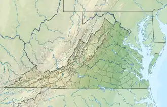 Location of South Fork Stewarts Creek mouth  South Fork Stewarts Creek (the United States) | |
| Location | |
| Country | United States |
| State | Virginia |
| County | Carroll |
| Physical characteristics | |
| Source | East Fork Chestnut Creek divide |
| • location | about 0.5 miles north of Rich Mountain |
| • coordinates | 36°34′55″N 080°48′47″W / 36.58194°N 80.81306°W[1] |
| • elevation | 2,900 ft (880 m)[2] |
| Mouth | |
• location | about 2 miles northwest of Lambsburg, Virginia |
• coordinates | 36°35′49″N 080°47′12″W / 36.59694°N 80.78667°W[1] |
• elevation | 1,683 ft (513 m)[3] |
| Length | 2.66 mi (4.28 km)[4] |
| Basin size | 2.17 square miles (5.6 km2)[5] |
| Discharge | |
| • location | Stewarts Creek |
| • average | 5.30 cu ft/s (0.150 m3/s) at mouth with Stewarts Creek[5] |
| Basin features | |
| Progression | Stewarts Creek → Ararat River → Yadkin River → Pee Dee River → Winyah Bay → Atlantic Ocean |
| River system | Yadkin River |
| Tributaries | |
| • left | unnamed tributaries |
| • right | unnamed tributaries |
| Bridges | none |
South Fork Stewarts Creek is a 2.66 mi (4.28 km) long 1st order tributary to Stewarts Creek in Carroll County, Virginia. This stream. along with North Fork Stewarts Creek, forms Stewarts Creek.
Course
South Fork Stewarts Creek rises about 0.5 miles north of Rich Mountain in Carroll County and then flows generally east to join Stewarts Creek about 2 miles northwest of Lambsburg, Virginia.[3]
Watershed
South Fork Stewarts Creek drains 2.17 square miles (5.6 km2) of area, receives about 54.4 in/year of precipitation, has a wetness index of 263.01, and is about 89% forested.[5]
See also
References
- 1 2 "GNIS Detail - South Fork Stewarts Creek". geonames.usgs.gov. US Geological Survey. Retrieved 21 July 2021.
- ↑ "Get Maps". USGS Topoview. US Geological Survey. Retrieved 21 July 2021.
- 1 2 "Get Maps". USGS Topoview. US Geological Survey. Retrieved 21 July 2021.
- ↑ "ArcGIS Web Application". epa.maps.arcgis.com. US EPA. Retrieved 21 July 2021.
- 1 2 3 "South Fork Stewarts Creek Watershed Report". US EPA Geoviewer. US EPA. Retrieved 21 July 2021.
This article is issued from Wikipedia. The text is licensed under Creative Commons - Attribution - Sharealike. Additional terms may apply for the media files.