| Shire of Southern Grampians Victoria | |||||||||||||||
|---|---|---|---|---|---|---|---|---|---|---|---|---|---|---|---|
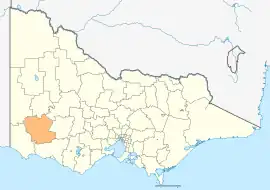 Location in Victoria | |||||||||||||||
| Population | 16,135 (2018)[1] | ||||||||||||||
| • Density | 2.42486/km2 (6.2804/sq mi) | ||||||||||||||
| Established | 1994 | ||||||||||||||
| Gazetted | 23 September 1994[2] | ||||||||||||||
| Area | 6,654 km2 (2,569.1 sq mi)[1] | ||||||||||||||
| Mayor | Cr Chris Sharples (since 2019) | ||||||||||||||
| Council seat | Hamilton | ||||||||||||||
| Region | Barwon South West | ||||||||||||||
| State electorate(s) | Lowan | ||||||||||||||
| Federal division(s) | Wannon | ||||||||||||||
| Website | Shire of Southern Grampians | ||||||||||||||
| |||||||||||||||
The Shire of Southern Grampians is a local government area (LGA) in the Barwon South West region of Victoria, Australia, located in the south-western part of the state. It covers an area of 6,654 square kilometres (2,569 sq mi) and in June 2018 had a population of 16,135.[1] It includes the city of Hamilton and the towns of Coleraine, Dunkeld and Penshurst. It was formed in 1994 from the amalgamation of the City of Hamilton, Shire of Wannon and parts of the Shire of Dundas, Shire of Kowree, Shire of Mount Rouse and Shire of Heywood.[2][3]
The Shire is governed and administered by the Southern Grampians Shire Council; its seat of local government and administrative centre is located at the council headquarters in Hamilton, it also has service centres located in a couple of other locations within Hamilton. The Shire is named after the major geographical feature in the region, The Grampians, and that the southern part of this feature occupies the northern part of the LGA.
Traditional owners
The traditional owners of this shire are the Gunditjmara, Tjap Wurrung and Bunganditj people.[4]
Council
Current composition
The council is composed of seven councillors elected to represent an unsubdivided municipality.[5] Council Composition as of September 2022:
| Ward | Councillor | Term | Notes | |
|---|---|---|---|---|
| Unsubdivided | David Robertson | 2020–Present | Deputy Mayor | |
| Bruach Colliton | 2008–2016, 2020–Present | Mayor | ||
| Helen Henry | 2020–Present | |||
| Mary-Ann Brown | 2016–Present | (Mayor 2016–2019) | ||
| Albert Cavano | 2008–Present | (Mayor 2012-2014) | ||
| Greg McAdam | 2016–Present | |||
| Katrina Rainsford | 2004–Present | |||
Administration and governance
The council meets in the council chambers at the council headquarters in the Hamilton Municipal Offices, which is also the location of the council's administrative activities. It also provides customer services at both its administrative centre on Brown Street in Hamilton, and its service centres on Market Pl and Roberts St in Hamilton.
Townships and localities
The 2021 census, the shire had a population of 16,588 up from 15,944 in the 2016 census[6]
| Population | ||
|---|---|---|
| Locality | 2016 | 2021 |
| Balmoral | 294 | 281 |
| Bellfield | 1,793 | 1,996 |
| Bochara | 81 | 84 |
| Branxholme^ | 351 | 304 |
| Brit Brit | 39 | 42 |
| Buckley Swamp | 25 | 21 |
| Bulart | 93 | 104 |
| Byaduk^ | 123 | 129 |
| Byaduk North | 119 | 134 |
| Caramut^ | 246 | 256 |
| Carapook^ | 70 | 67 |
| Cavendish | 334 | 366 |
| Cherrypool^ | 3 | 3 |
| Clover Flat^ | 17 | 15 |
| Coleraine | 1,029 | 1,062 |
| Coojar | 38 | 38 |
| Population | ||
|---|---|---|
| Locality | 2016 | 2021 |
| Croxton East | 70 | 70 |
| Culla | 35 | 31 |
| Dunkeld^ | 678 | 688 |
| Englefield | 23 | 23 |
| Gatum | 29 | 35 |
| Gazette^ | 43 | 42 |
| Glenisla^ | 16 | 23 |
| Glenthompson^ | 232 | 256 |
| Grampians | 0 | 0 |
| Gringegalgona | 21 | 44 |
| Gritjurk | 55 | 61 |
| Hamilton | 9,974 | 10,346 |
| Harrow^ | 200 | 184 |
| Hensley Park | 59 | 75 |
| Hilgay | 19 | 29 |
| Karabeal | 30 | 29 |
| Population | ||
|---|---|---|
| Locality | 2016 | 2021 |
| Konongwootong | 50 | 60 |
| Melville Forest | 42 | 63 |
| Mirranatwa | 26 | 31 |
| Mooralla | 83 | 79 |
| Morgiana | 31 | 29 |
| Mount Napier | 17 | 16 |
| Moutajup | 83 | 108 |
| Muntham^ | 31 | 29 |
| Nareeb^ | 36 | 48 |
| Nareen^ | 93 | 79 |
| Penshurst^ | 622 | 677 |
| Pigeon Ponds | 29 | 29 |
| Purdeet^ | 14 | 21 |
| Rocklands | 14 | 25 |
| Strathkellar | 93 | 84 |
| Population | ||
|---|---|---|
| Locality | 2016 | 2021 |
| Tabor | 39 | 38 |
| Tahara^ | 36 | 30 |
| Tarrayoukyan^ | 21 | 25 |
| Tarrenlea | 37 | 25 |
| Tarrington | 301 | 328 |
| Vasey | 49 | 45 |
| Victoria Point | 17 | 16 |
| Victoria Valley | 79 | 65 |
| Wando Vale^ | 104 | 96 |
| Wannon | 108 | 124 |
| Warrayure | 24 | 50 |
| Woodhouse | 39 | 34 |
| Wootong Vale | 46 | 32 |
| Yatchaw | 26 | 35 |
| Yulecart | 127 | 128 |
^ - Territory divided with another LGA
See also
References
- 1 2 3 "3218.0 – Regional Population Growth, Australia, 2017-18: Population Estimates by Local Government Area (ASGS 2018), 2017 to 2018". Australian Bureau of Statistics. Australian Bureau of Statistics. 27 March 2019. Retrieved 25 October 2019. Estimated resident population, 30 June 2018.
- 1 2 Victoria Government Gazette – Online Archive (1837–1997). "S63 of 1994: Order estg (Part 5) the Shire of Southern Grampians". State Library of Victoria. State Government of Victoria (published 23 September 1994). pp. 4–5. Retrieved 10 January 2014.
- ↑ Victoria Government Gazette – Online Archive (1837–1997). "S4 of 1995: Order altg (Part 13) the Shire of Southern Grampians". State Library of Victoria. State Government of Victoria (published 20 January 1995). p. 5. Retrieved 10 January 2014.
- ↑ "SOUTHERN GRAMPIANS SHIRE COUNCIL" (PDF).
- ↑ "Southern Grampians Shire Council election results 2020". Victorian Electoral Commission. 2020. Retrieved 13 September 2022.
- ↑ "Census | Australian Bureau of Statistics". www.abs.gov.au. 11 January 2023.
External links
![]() Media related to Shire of Southern Grampians at Wikimedia Commons
Media related to Shire of Southern Grampians at Wikimedia Commons
- Southern Grampians Shire Council official website
- Metlink local public transport map
- Link to Land Victoria interactive maps
Localities in the Shire of Southern Grampians | ||
|---|---|---|
| City |  | |
| Town | ||
| Locality |
| |
^ - Territory divided with another LGA | ||