St. Catherine International Airport | |||||||||||
|---|---|---|---|---|---|---|---|---|---|---|---|
| Summary | |||||||||||
| Airport type | Public | ||||||||||
| Operator | Government | ||||||||||
| Location | St. Catherine, Egypt | ||||||||||
| Elevation AMSL | 4,368 ft / 1,331 m | ||||||||||
| Coordinates | 28°41′07″N 034°03′45″E / 28.68528°N 34.06250°E | ||||||||||
| Map | |||||||||||
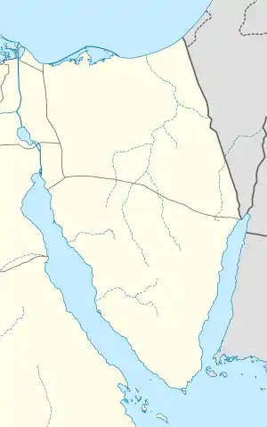
 SKV Location within Egypt | |||||||||||
| Runways | |||||||||||
| |||||||||||
St. Catherine International Airport (IATA: SKV, ICAO: HESC) is an airport serving St. Catherine (or St. Katherine[3]), Saint Katherine city in the South Sinai Governorate of Egypt. It is located about 20 km (12 mi.) northeast of the city, which is near Mount Sinai.
Airlines and destinations
There are currently no scheduled services to and from the airport. In 2011, the airport served 247 passengers (-72.6% vs. 2010).
References
- ↑ "Airport information for HESC". World Aero Data. Archived from the original on 2019-03-05.
{{cite web}}: CS1 maint: unfit URL (link) Data current as of October 2006. Source: DAFIF. - ↑ Airport information for SKV at Great Circle Mapper. Source: DAFIF (effective October 2006).
- ↑ St. Katherine (St. Catherine's City), South Sinai Governorate, Egypt
External links
This article is issued from Wikipedia. The text is licensed under Creative Commons - Attribution - Sharealike. Additional terms may apply for the media files.