| Stanislaus Peak | |
|---|---|
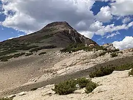 Southeastern face of Stanislaus Peak | |
| Highest point | |
| Elevation | 11,233 ft (3,424 m) |
| Prominence | 833 ft (254 m) |
| Coordinates | 38°23′3″N 119°40′2″W / 38.38417°N 119.66722°W |
| Geography | |
| Location | Alpine and Mono counties, California, U.S. |
| Parent range | Sierra Nevada |
| Topo map | USGS |
| Climbing | |
| Easiest route | off trail hike, Simple scramble, class 2 |
Stanislaus Peak is a prominent peak near Sonora Pass in the Sierra Nevada range in California, United States.[1] It is located in the Carson–Iceberg Wilderness in the federally-managed Stanislaus National Forest.[2]
Geology
Stanislaus peak is an ancient volcanic cone[3] composed of andesite intrusion.[4] Near the base of the mountain is a granite outcropping formed during the Late Triassic to Late Cretaceous periods.[5] The granite features are also found in nearby areas, such as Yosemite National Park and the Emigrant Wilderness.
Hiking

The peak can be hiked via the trail from Saint Mary's Pass near Sonora Pass. The trail ends at the granite outcropping just below the peak and route finding and a class 2 scramble is required to reach the summit via the easiest approach from the southeast face.[6]
References
- ↑ "Geographic Names Information System". Edits.nationalmap.gov. Retrieved September 5, 2022.
- ↑ https://www.peakbagger.com/peak.aspx?pid=13562
- ↑ hgrapid. "Stanislaus Peak : Climbing, Hiking & Mountaineering". SummitPost. Retrieved September 5, 2022.
- ↑ https://busby.faculty.geol.ucsb.edu/library/pdf/2018_Busby%20et%20al._Geosphere.pdf
- ↑ "Mesozoic granitic rocks, unit 3 (Sierra Nevada, Death Valley area, Northern Mojave Desert and Transverse Ranges) (CAgrMZ3;0)". Mrdata.usgs.gov. Retrieved September 5, 2022.
- ↑ "Stanislaus Peak – Climber.Org Trip Report". Climber.org. Retrieved September 5, 2022.