| Stanovik Range | |
|---|---|
| Становик | |
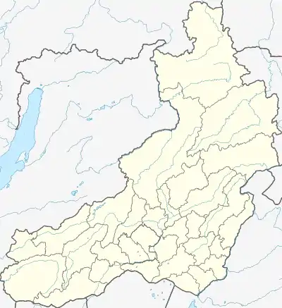
 Map of the area with part of the Stanovik in the right. | |
| Highest point | |
| Peak | Unnamed |
| Elevation | 1,916 m (6,286 ft) |
| Dimensions | |
| Length | 110 km (68 mi) NE/SW |
| Width | 40–70 km (25–43 mi) SE/NW |
| Geography | |
 Location in the Transbaikal region | |
| Country | Russia |
| Krai | Zabaykalsky Krai |
| Range coordinates | 50°0′N 112°12′E / 50.000°N 112.200°E |
| Parent range | Khentei-Daur Highlands |
| Geology | |
| Orogeny | Alpine orogeny |
| Age of rock | Jurassic |
| Type of rock | Volcanic rock and granodiorite |
| Climbing | |
| Easiest route | From Mordoy or Kyra |
The Stanovik (Russian: Становик) is a mountain range in the Transbaikal Region (Zabaykalsky Krai) of Siberia, Russia.[1] The southern end of the range is very close to the border with Mongolia. The nearest village is Mordoy (Мордой), Kyrinsky District.[2]
The range is part of the Trans-Baikal conifer forests ecoregion.[3]
Geography
The Stanovik Range is part of the Khentei-Daur Highlands, South Siberian System. It rises on the left bank of the upper course of the Onon River and stretches roughly northeastwards for over 110 kilometers (68 mi) between two of its left tributaries, the Kyra and the Aksha. It is bound by the Bylir River valley to the west and near its source it connects with the Khentei Range. The width of the Stanovik ranges between a maximum of 70 kilometers (43 mi) and a minimum of 40 kilometers (25 mi).[2]
The average summits of the Stanovik reach between 1,200 meters (3,900 ft) and 1,600 meters (5,200 ft). The highest point is a 1,916 meters (6,286 ft) high unnamed peak. Much like in neighboring ranges, the relief is dominated by moderate height mountains with an abundance of steep-slopes and faults. The summits display fragments of the original alignment surface. The range rises in an area prone to earthquakes.[3]
Flora
The slopes of the range are covered with mountain taiga and pre-Alpine forest. The higher elevations have dwarf cedar shrub and are often crowned by golets type bare summits.[1]
See also
References
- 1 2 "Становик, хребет" [Stanovik Range] (in Russian). Энциклопедия Забайкалья. Retrieved 1 November 2021.
- 1 2 Google Earth
- 1 2 "Sokhondinskiy Biosphere Reserve". UNESCO. Retrieved 4 February 2020.