| Staples River | |
|---|---|
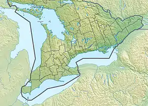
 Location of the mouth of the river in Southern Ontario | |
| Location | |
| Country | Canada |
| Province | Ontario |
| Region | Central Ontario |
| Municipality | Kawartha Lakes |
| Physical characteristics | |
| Source | Unnamed confluence |
| • location | Eldon Township |
| • coordinates | 44°25′38″N 78°57′27″W / 44.427291900669054°N 78.95754780227682°W |
| • elevation | 274 m (899 ft) |
| Mouth | Balsam Lake |
• location | Fenelon Township |
• coordinates | 44°33′08″N 78°53′30″W / 44.55222°N 78.89167°W[1] |
• elevation | 256 m (840 ft) |
| Length | 18 km (11 mi) |
| Basin size | 4,792 ha (11,840 acres) |
| Basin features | |
| River system | Great Lakes Basin |
The Staples River is a river in Kawartha Lakes in Central Ontario, Canada.[1][2][3][4] It is in the Great Lakes Basin and is a tributary of Balsam Lake. The river is 18 kilometres (11 mi) long and has a watershed of 4,792 hectares (11,840 acres).[5]
The river begins at an unnamed confluence of streams, northwest of the community of Grasshill in geographic Eldon Township, and flows northeast to its mouth at the West Bay on Balsam Lake in geographic Fenelon Township, at the summit of the Trent–Severn Waterway.[1][2]
References
- 1 2 3 "Staples River". Geographical Names Data Base. Natural Resources Canada. Retrieved 2018-07-06.
- 1 2 "CLAIMaps IV". Ontario Ministry of Northern Development and Mines. 2016. Retrieved 2018-07-06.
- ↑ Map 5 (PDF) (Map). 1 : 700,000. Official road map of Ontario. Ministry of Transportation of Ontario. 2010-01-01. Retrieved 2018-07-06.
- ↑ Restructured municipalities - Ontario map #5 (Map). Restructuring Maps of Ontario. Ontario Ministry of Municipal Affairs and Housing. 2006. Retrieved 2018-07-06.
- ↑ "Staples River Subwatershed". Kawartha Conservation. Retrieved 2018-07-06.
This article is issued from Wikipedia. The text is licensed under Creative Commons - Attribution - Sharealike. Additional terms may apply for the media files.