| Starzlach | |
|---|---|
 | |
| Location | |
| Country | Germany |
| State | Bavaria |
| Physical characteristics | |
| Source | |
| • location | Piesenkopf (1629 m) |
| Mouth | |
• location | Breitach |
• coordinates | 47°24′15″N 10°13′53″E / 47.4042°N 10.2315°E |
• elevation | 820 m (2,690 ft) |
| Length | 8.2 km (5.1 mi) [1] |
| Basin features | |
| Progression | Breitach→ Iller→ Danube→ Black Sea |
| Tributaries | |
| • left | Letzenbach |
| • right | Hörnlegraben |
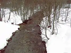
Starzlach is a river in the Allgäu region of the Bavarian Alps. Located in the Northwest of Rohrmoos (part of Oberstdorf) and west of Oberstdorf itself it flows into the river Breitach. Its main tributaries are Hörnlegraben and Letzenbach.
Wikimedia Commons has media related to Starzlach.
See also
References
- ↑ Complete table of the Bavarian Waterbody Register by the Bavarian State Office for the Environment (xls, 10.3 MB)
This article is issued from Wikipedia. The text is licensed under Creative Commons - Attribution - Sharealike. Additional terms may apply for the media files.