 | ||||
|---|---|---|---|---|
| Serbian: Državni put IB reda 24 Serbian Cyrillic: Државни пут IБ реда 24 | ||||
 | ||||
| Route information | ||||
| Maintained by JP "Putevi Srbije" | ||||
| Length | 75.397 km (46.850 mi) | |||
| Major junctions | ||||
| From | Batočina | |||
| To | Kraljevo | |||
| Location | ||||
| Country | Serbia | |||
| Districts | Šumadija, Raška | |||
| Highway system | ||||
| ||||
 | |
|---|---|
| Serbian: Brzi put 24 Serbian Cyrillic: Брзи пут 24 | |
 | |
| Route information | |
| Maintained by JP "Putevi Srbije" | |
| Length | 12.041 km (7.482 mi) 15.667 km (9.735 mi) planned 3.626 km (2.253 mi) under construction |
| Major junctions | |
| From | Batočina |
| To | Kragujevac |
| Location | |
| Country | Serbia |
| Districts | Šumadija |
| Highway system | |
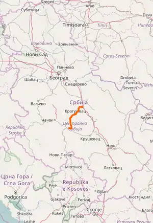
State Road 24 is an IB-class/expressway road in central Serbia, connecting Batočina with Kraljevo. It is located in Šumadija and Western Serbia.[1]
Before the new road categorization regulation given in 2013, the route wore the following names: M 1.11, M 23 and M 23.1 (before 2012) / 15 and 16 (after 2012).[2][3]
The existing route is a main road with two traffic lanes, except for Batočina – Kragujevac section which is partially built by expressway standards, and defined in the Space Plan of Republic of Serbia.[4]
Sections
| Section number | Length | Distance | Section name |
|---|---|---|---|
| 02401 | 0.585 km (0.364 mi) | 0.585 km (0.364 mi) | Batočina interchange – Batočina |
| 02491 | 4.447 km (2.763 mi) | 5.032 km (3.127 mi) | Batočina – Batočina (start of constructed expressway) |
| 02492 | 6.121 km (3.803 mi)/6.119 km (3.802 mi) | 11.153 km (6.930 mi) | Batočina (start of constructed expressway) – Žirovnica (end of constructed expressway) |
| 02494 | 3.626 km (2.253 mi) | 14.779 km (9.183 mi) | Žirovnica (end of constructed expressway) – Botunje (start of constructed expressway) |
| 02495 | 9.546 km (5.932 mi)/9.557 km (5.938 mi) | 24.325 km (15.115 mi) | Botunje (start of constructed expressway) – Kragujevac |
| 02404 | 2.007 km (1.247 mi)/0.914 km (0.568 mi) | 26.332 km (16.362 mi) | Kragujevac – Kragujevac (Cerovac) |
| 02405 | 1.199 km (0.745 mi) | 27.531 km (17.107 mi) | Kragujevac (Cerovac) – Kragujevac (Divostin) |
| 02406 | 15.513 km (9.639 mi) | 43.044 km (26.746 mi) | Kragujevac (Divostin) – Ravni Gaj |
| 02407 | 25.777 km (16.017 mi) | 68.821 km (42.763 mi) | Ravni Gaj – Vitanovac |
| 02408 | 6.576 km (4.086 mi) | 75.397 km (46.850 mi) | Vitanovac – Kraljevo (Kamidžora) |
See also
- Roads in Serbia
- Expressway 24
- National Road (M)1.11
- National Road (M)23
- National Road (M)23.1
References
- ↑ "Republic of Serbia – national road network" (PDF). Putevi Srbije (in Serbian).
- ↑ "National road categorization regulation – Official Gazette of Republic of Serbia no. 105/2013 and 119/2013" (PDF). Serbian Spatial Planners Association (in Serbian).
- ↑ "Link between actual and previous section and road markings" (PDF). Putevi Srbije (in Serbian).
- ↑ Space plan of Republic of Serbia from 2010 to 2021
External links
This article is issued from Wikipedia. The text is licensed under Creative Commons - Attribution - Sharealike. Additional terms may apply for the media files.