| Staunton-in-the-Vale | |
|---|---|
| Civil parish | |
.JPG.webp) St Mary's, Staunton | |
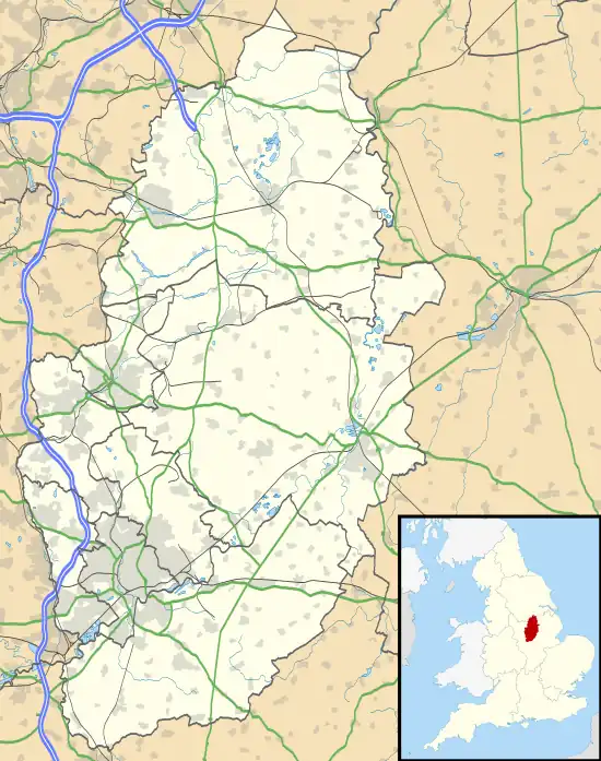
 Staunton-in-the-Vale Location within Nottinghamshire | |
| Area | 2.15 sq mi (5.6 km2) |
| Population | 243 (2011) (with Alverton, Cotham and Kilvington) [1] |
| • Density | 113/sq mi (44/km2) |
| OS grid reference | SK 80590 43684 |
| District | |
| Shire county | |
| Region | |
| Country | England |
| Sovereign state | United Kingdom |
| Post town | NOTTINGHAM |
| Postcode district | NG13 |
| Dialling code | 01400 / 01949 |
| Police | Nottinghamshire |
| Fire | Nottinghamshire |
| Ambulance | East Midlands |
| UK Parliament | |
Staunton (also known as Staunton-in-the-Vale) is a small village and civil parish in the Newark and Sherwood district of Nottinghamshire, England. It takes its name from the Vale of Belvoir and shares it with the local Staunton family, which has resided in the area since the Norman Conquest and possibly before, making them one of the English families living longest on its own estate.
Geography
The settlement lies 15 miles east of Nottingham, 6 miles south of Newark-on-Trent, and 6 miles north of Belvoir, within the Vale of Belvoir. The land is generally very low-lying and level, averaging 20 metres (66 ft) in elevation, except for a ridge north of the village centre that rises to 35 metres (115 ft), and the highest point of Folly Hill at 46 metres (151 ft) on the eastern boundary of the parish. The conjunction of three counties, Three Shire Oak, is by the south-east corner of the parish. The population was 243 at the 2011 census, grouping together nearby parish counts.[2] The village is mainly rural, with much farmland, but very little in the way of amenities.
Staunton's neighbours include
- Cotham, Nottinghamshire to the north
- Flawborough and Shelton, Nottinghamshire to the west
- Alverton, Kilvington, and Normanton/Bottesford, Leicestershire to the south
- Long Bennington, Lincolnshire to the east
The historic village area is primarily by the crossroads in the High Street. The Back Dyke forms the northern boundary of the parish and the River Devon the southern.
Local leisure areas include Stanton Park to the south-east of the village centre, and the Staunton Quarry Nature Reserve by the Back Dyke, which is a reclaimed gypsum/limestone mine, notable as a preserve of the Grizzled Skipper butterfly.[3]
Economy
Most of the parish consists of agricultural land, which accounts for some local employment.
The only public house, the Staunton Arms, stands in the High Street at the crossroads.
The Staunton Industrial Estate maintains units and workshops for small-scale manufacturing about 1 km (0.62 mi) north-west of the village, off Grange Lane.
Education
Staunton School, in the High Street, is primarily a nursery, started in 2001 and run by Staunton family members.[4] Private schooling is also available for older children.
History
In the Domesday Book of 1086, the village was known as Stanton. It was recorded that Malger held the manor through the feudal tenure of the castle guard at Belvoir. He had charge of a high tower known as Staunton's Tower. Whenever the Royal Family visits Belvoir, the head of the Staunton family attends and presents the golden key of the tower, as did the Rev. F. Staunton on the occasion of the first visit of the Prince of Wales Malger's father, Sir Bryan de Staunton (1040–1100), is the first known member of this family. The family had French origins and it is believed that the mispronunciation in spelling is derived from this. The Staunton Tower at Belvoir Castle is a reminder of the Stauntons' connections.[5] The family maintained Lord of the Manor rights into modern times, and continue to play a role in local affairs through the civil parish administration.[6]
Railway
The Great Northern and London and North Western Joint Railway ran a line from Melton Mowbray railway station (initially Melton) via the Bottesford South junction to Newark North Gate through the western part of the parish, but the nearest station was at Cotham. The line closed in 1987.[7]
Landmarks
Staunton Hall
Located on the south end of the High Street, the 16th-century Hall is a Grade II* listed building,[8] and is still the Staunton family's main residence.
St Mary's Church
This stands in the hall grounds and was the family chapel. It is now the parish church for Staunton and Flawborough. The Domesday Book records a church and a priest in the village, but it is unclear if it was on the present site. Certain church features have been dated as far back as the 12th century.[9]
Listed buildings
Several structures and buildings throughout the parish have listed status, including the hall and church and the Staunton Arms public house from the early 19th century,[10] a vintage telephone kiosk, and a wall with notable features.[11]
References
- ↑ Custom report – Nomis – Official Labour Market Statistics
- ↑ "Custom report - Nomis - Official Labour Market Statistics". www.nomisweb.co.uk. Retrieved 1 November 2020.
- ↑ "Butterfly Conservation – Work Parties". www.eastmidlands-butterflies.org.uk. Retrieved 1 November 2020.
- ↑ "There will always be an England..." Staunton Montessori Nursery School. Retrieved 2 November 2020.
- ↑ "A Very English Scene". Staunton Montessori Nursery School. Retrieved 2 November 2020.
- ↑ Council, Nottinghamshire County. "Staunton Parish Meeting". Nottinghamshire County Council. Retrieved 2 November 2020.
- ↑ "Newark to Cotham Cycle Route – Visit Nottinghamshire". www.visit-nottinghamshire.co.uk. Retrieved 2 November 2020.
- ↑ Stuff, Good. "Staunton Hall and Service Wing, Nottingham, Nottinghamshire". britishlistedbuildings.co.uk. Retrieved 1 November 2020.
- ↑ "Nottinghamshire history > Articles > Articles form the Transactions of the Thoroton Society > Staunton-in-the-Vale". www.nottshistory.org.uk. Retrieved 2 November 2020.
- ↑ Stuff, Good. "The Staunton Arms Public House, Staunton in the Vale, Nottingham, Nottinghamshire". britishlistedbuildings.co.uk. Retrieved 2 November 2020.
- ↑ "Listed Buildings in Staunton, Newark and Sherwood, Nottinghamshire". britishlistedbuildings.co.uk. Retrieved 2 November 2020.