Stronghurst Township | |
|---|---|
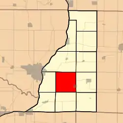 Location in Henderson County | |
 Henderson County's location in Illinois | |
| Coordinates: 40°45′49″N 90°57′49″W / 40.76361°N 90.96361°W | |
| Country | |
| State | |
| County | Henderson |
| Established | November 6, 1906 |
| Area | |
| • Total | 35.91 sq mi (93.0 km2) |
| • Land | 35.91 sq mi (93.0 km2) |
| • Water | 0 sq mi (0 km2) 0% |
| Elevation | 587 ft (179 m) |
| Population (2010) | |
| • Estimate (2016)[1] | 1,036 |
| • Density | 31/sq mi (12/km2) |
| Time zone | UTC-6 (CST) |
| • Summer (DST) | UTC-5 (CDT) |
| ZIP codes | 61418, 61425, 61437, 61480 |
| FIPS code | 17-071-73274 |
Stronghurst Township is one of eleven townships in Henderson County, Illinois, USA. As of the 2010 census, its population was 1,115 and it contained 500 housing units.[2]
Geography
According to the 2010 census, the township has a total area of 35.91 square miles (93.0 km2), all land.[2]
Cities, towns, villages
- Stronghurst (west three-quarters)
Unincorporated towns
- Decorra at 40°43′40″N 90°58′13″W / 40.727818°N 90.970141°W
- Hopper at 40°47′08″N 90°59′27″W / 40.785596°N 90.990697°W
- Olena at 40°47′08″N 90°56′20″W / 40.785595°N 90.938752°W
(This list is based on USGS data and may include former settlements.)
Cemeteries
The township contains these five cemeteries: Best, Hopper, Maple Grove, Olena and Watson.
Major highways
Demographics
| Census | Pop. | Note | %± |
|---|---|---|---|
| 2016 (est.) | 1,036 | [1] | |
| U.S. Decennial Census[3] | |||
School districts
- West Central Community Unit School District 235
Political districts
- Illinois's 17th congressional district
- State House District 94
- State Senate District 47
References
- United States Census Bureau 2008 TIGER/Line Shapefiles
- "Stronghurst Township". Geographic Names Information System. United States Geological Survey, United States Department of the Interior. Retrieved September 19, 2009.
- United States National Atlas
- 1 2 "Population and Housing Unit Estimates". Retrieved June 9, 2017.
- 1 2 "Population, Housing Units, Area, and Density: 2010 - County -- County Subdivision and Place -- 2010 Census Summary File 1". United States Census. Archived from the original on February 12, 2020. Retrieved May 28, 2013.
- ↑ "Census of Population and Housing". Census.gov. Retrieved June 4, 2016.
External links
Places adjacent to Stronghurst Township, Henderson County, Illinois | ||||||||||||||||
|---|---|---|---|---|---|---|---|---|---|---|---|---|---|---|---|---|
| ||||||||||||||||
Municipalities and communities of Henderson County, Illinois, United States | ||
|---|---|---|
| City | Map of Illinois highlighting Henderson County | |
| Villages | ||
| Townships | ||
| CDP | ||
| Other communities | ||
| Footnotes | ‡This populated place also has portions in an adjacent county or counties | |
This article is issued from Wikipedia. The text is licensed under Creative Commons - Attribution - Sharealike. Additional terms may apply for the media files.