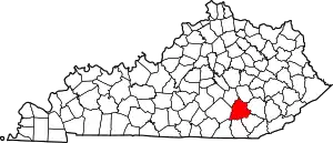
Sublimity City | |
|---|---|
 Sublimity City Location within the state of Kentucky  Sublimity City Sublimity City (the United States) | |
| Coordinates: 37°5′40″N 84°5′1″W / 37.09444°N 84.08361°W | |
| Country | United States |
| State | Kentucky |
| County | Laurel |
| Elevation | 1,214 ft (370 m) |
| Time zone | UTC-5 (Eastern (EST)) |
| • Summer (DST) | UTC-4 (EST) |
| GNIS feature ID | 515771[1] |
Sublimity City is an unincorporated community located in Laurel County, Kentucky, United States. Originally known as the Sublimity Forest Community, it was developed under the authority of the Emergency Relief Appropriation Act of 1935.[2]
References
- ↑ U.S. Geological Survey Geographic Names Information System: Sublimity City, Kentucky
- ↑ "A History of the Daniel Boone National Forest 1770 - 1970 (Chapter 30)". foresthistory.org. Archived from the original on March 1, 2014.
This article is issued from Wikipedia. The text is licensed under Creative Commons - Attribution - Sharealike. Additional terms may apply for the media files.
