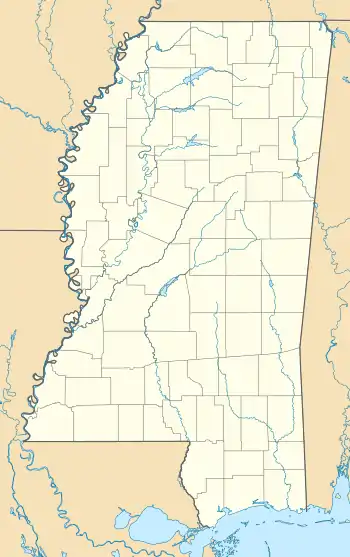
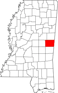
Sucarnoochee, Mississippi | |
|---|---|
 Sucarnoochee  Sucarnoochee | |
| Coordinates: 32°43′52″N 88°28′23″W / 32.73111°N 88.47306°W | |
| Country | United States |
| State | Mississippi |
| County | Kemper |
| Elevation | 223 ft (68 m) |
| Time zone | UTC-6 (Central (CST)) |
| • Summer (DST) | UTC-5 (CDT) |
| GNIS feature ID | 678379[1] |
Sucarnoochee is an unincorporated community in Kemper County, Mississippi, United States. Its post office [2] has been closed. It was also known as Sucarnooche.
The community was named from its location near the Sucarnoochee River.[3]
Sucarnoochee is located on the Kansas City Southern Railway.[4] In 1900, Sucarnoochee's population was 92.[5]
References
- ↑ "Sucarnoochee". Geographic Names Information System. United States Geological Survey, United States Department of the Interior.
- ↑ "Sucarnoochee Mississippi post office". Geographic Names Information System. United States Geological Survey, United States Department of the Interior.
- ↑ Baca, Keith A. (June 1, 2007). Native American place names in Mississippi. University Press of Mississippi. p. 98. ISBN 978-1-57806-954-5.
- ↑ Howe, Tony. "Sucarnochee, Mississippi". Mississippi Rails. Retrieved July 4, 2022.
- ↑ Rowland, Dunbar (1907). Mississippi: Comprising Sketches of Counties, Towns, Events, Institutions, and Persons, Arranged in Cyclopedic Form (PDF). Vol. 2. Southern Historical Publishing Association. p. 747.
This article is issued from Wikipedia. The text is licensed under Creative Commons - Attribution - Sharealike. Additional terms may apply for the media files.
