Sunraysia Highway | |
|---|---|
 | |
| Sunraysia Highway, just outside Birchip. | |
 Northwest end Southeast end | |
| Coordinates |
|
| General information | |
| Type | Highway |
| Length | 330 km (205 mi)[1] |
| Opened | 1948 |
| Route number(s) | |
| Former route number | |
| Major junctions | |
| Northwest end | Nunga, Victoria |
| Southeast end | Miners Rest, Victoria |
| Location(s) | |
| Major settlements | Speed, Lascelles, Woomelang, Birchip, Donald, St Arnaud, Avoca, Lexton |
| Highway system | |
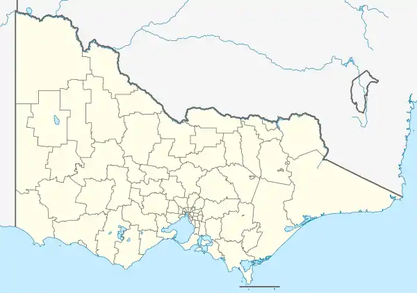
The Sunraysia Highway (route B220) is a 344 kilometres (214 mi) arterial north–south route in western Victoria. The highway extends north a length of 331 km starting from the Western Freeway near Ballarat to the Calder Highway near Ouyen. It is the north-west arterial road, linking Ballarat and Ouyen, and acts as a secondary route to the Calder Highway, the primary route between Melbourne and Mildura.
The Sunraysia Highway serves a number of important industries in the region such as agriculture, viticulture, food processing, winemaking and tourism. It forms an important link for these industries to markets and ports in the south of Victoria and South Australia. It is a two-lane, two-way road with shoulders. It has no overtaking lanes provided along the highway, as it is designated as a ‘B’ road for its full length.
History
The passing of the Highways and Vehicles Act of 1924[2] through the Parliament of Victoria provided for the declaration of State Highways, roads two-thirds financed by the State government through the Country Roads Board (later VicRoads). The North-Western Highway (not to be confused by the Calder Highway, which was also known as the North-Western Highway in the late 1920s) was declared a State Highway in the 1947/48 financial year,[3] from Ballarat via Avoca, St Arnaud, and Donald to Birchip (for a total of 138 miles); before this declaration, the roads were referred to as St Arnaud-Birchip Road, Avoca-St Arnaud Road and Avoca-Ballarat.[4] In the 1959/60 financial year, another section from Birchip via Woomelang to Lascelles was added,[5] along the former Beulah-Birchip-Wycheproof Road, Kinnabulla-Woomelang Road and Woomelang-Lascelles Roads.[5] The name of the highway was later changed to the Sunraysia Highway on 11 September 1972, and extended from Lascelles to Nunga, just south of Ouyen, subsuming the former portion of Henty Highway previously declared to Ouyen.[6]
The Sunraysia Highway was signed as State Route 121 between Ouyen and Ballarat in 1986;[7] with Victoria's conversion to the newer alphanumeric system in the late 1990s, it was replaced by route B220.
The passing of the Road Management Act 2004[8] granted the responsibility of overall management and development of Victoria's major arterial roads to VicRoads: in 2013, VicRoads re-declared the road as Sunraysia Highway (Arterial #6700) between the Calder Highway in Nunga (south of Ouyen) and the Western Freeway at Mitchell Park (in north-western Ballarat).[9]
Towns
Major intersections
| LGA | Location[1][9] | km[1] | mi | Destinations | Notes |
|---|---|---|---|---|---|
| Mildura | Nunga | 0 | 0.0 | Northern terminus of highway and route B220 (10km south of Ouyen) | |
| Yarriambiack | Speed | 28.1 | 17.5 | ||
| Lascelles | 55.9 | 34.7 | |||
| Woomelang | 68.8 | 42.8 | |||
| Buloke | Ballapur | 107.0 | 66.5 | ||
| Birchip | 118.3 | 73.5 | |||
| Morton Plains | 128.0 | 79.5 | |||
| Litchfield | 156.1 | 97.0 | |||
| Donald | 170.5 | 105.9 | |||
| 171.2 | 106.4 | ||||
| Northern Grampians | St Arnaud | 209.2 | 130.0 | ||
| 209.8 | 130.4 | Concurrency with route B240 | |||
| 210.6 | 130.9 | ||||
| Moyreisk | 242.5 | 150.7 | |||
| Pyrenees | Tanwood | 258.8 | 160.8 | ||
| Avoca | 271.4 | 168.6 | |||
| Lexton | 294.6 | 183.1 | |||
| Ballarat | Miners Rest | 330.2 | 205.2 | Trumpet interchange; southern terminus of highway and route B220 | |
1.000 mi = 1.609 km; 1.000 km = 0.621 mi
| |||||
See also
References
- 1 2 3 Google (12 October 2021). "Sunraysia Highway" (Map). Google Maps. Google. Retrieved 12 October 2021.
- ↑ State of Victoria, An Act to make further provision with respect to Highways and Country Roads Motor Cars and Traction Engines and for other purposes 30 December 1924
- ↑ "Country Roads Board Victoria. Thirty-Fifth Annual Report: for the year ended 30 June 1948". Country Roads Board of Victoria. Melbourne: Victorian Government Library Service. 1 November 1948. p. 7.
- ↑ "Country Roads Board Victoria. Twenty-Sixth Annual Report: for the year ended 30 June 1939". Country Roads Board of Victoria. Melbourne: Victorian Government Library Service. 10 November 1939. pp. 84, 88, 92, 98.
- 1 2 "Country Roads Board Victoria. Forty-Seventh Annual Report: for the year ended 30 June 1960". Country Roads Board of Victoria. Melbourne: Victorian Government Library Service. 21 November 1960. pp. 7–8.
- ↑ "Country Roads Board Victoria. Sixtieth Annual Report: for the year ended 30 June 1973". Country Roads Board of Victoria. Melbourne: Victorian Government Library Service. 1 November 1973. p. 14.
- ↑ "Road Construction Authority of Victoria. Annual Report for the year ended 30 June 1986". Road Construction Authority of Victoria. Melbourne: Victorian Government Library Service. 24 November 1986. p. 42.
- ↑ State Government of Victoria. "Road Management Act 2004" (PDF). Government of Victoria. Archived (PDF) from the original on 18 October 2021. Retrieved 19 October 2021.
- 1 2 VicRoads. "VicRoads – Register of Public Roads (Part A) 2015" (PDF). Government of Victoria. pp. 1015–6. Archived from the original on 1 May 2020. Retrieved 19 October 2021.
External links
![]() Media related to Sunraysia Highway at Wikimedia Commons
Media related to Sunraysia Highway at Wikimedia Commons