| Taboche | |
|---|---|
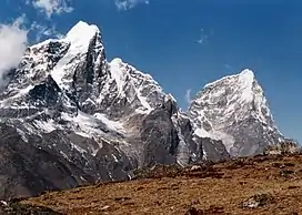
 Taboche (left) and Cholatse (right) | |
| Highest point | |
| Elevation | 6,495 m (21,309 ft)[1] |
| Prominence | 1,121 m (3,678 ft) |
| Coordinates | 27°53′48″N 86°46′39″E / 27.89667°N 86.77750°E |
| Geography | |
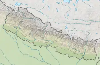
 Taboche Location in Nepal | |
| Location | Khumbu, Nepal |
| Parent range | Khumbu Himal |
| Climbing | |
| First ascent | 1974 |
| Easiest route | rock/snow/ice climb |
Taboche (also known as Tawoche, Tobuche, Tāuje, Taweche, Tawache or Tawetse) is a mountain in the Khumbu region of the Nepalese Himalaya. Taboche is connected to Cholatse by a long ridge. Taboche lies directly across the Imja River from Ama Dablam and above the villages of Pheriche and Dingboche.
The first ascent was made in 1974 by a French expedition led by Yannick Seigneur and the clarinettist and composer Jean-Christian Michel.[2] The summit team included Louis Dubost, Paul Gendre and Jacques Brugirard.
Other notable ascents
- 1989 The direct north-east face of Taboche (Tawoche) was climbed in winter by Jeff Lowe and John Roskelley alpine-style during a ten-day push in February, 1989. They reached the summit on February 13. The route follows the deep vertical cleft up the center of the face. The climb is documented in Last Days, a book by John Roskelley (1991).
- 2009 Direct North Face (VI AI5 R, 1500m). First ascent by Giri-Giri Boys Fumitaka Ichimura and Genki Narumi (Japan). Summit attained November 28.[3]

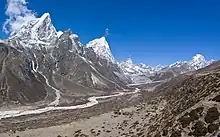
Taboche at left and Cholatse at center
References
- ↑ "Taboche". Peakware.com. Archived from the original on 2016-03-04.
- ↑ 1975 American Alpine Journal. The Mountaineers Books. ISBN 978-1-933056-30-2.
- ↑ Lambert, Erik (Jan 20, 2010). "Tawoche Details: Dangerous Ice for Giri-Giri Boys". Alpinist Newswire. Alpinist Magazine. Retrieved Feb 7, 2010.
Books
- John Roskelley "Last Days", (Stackpole Books, 1991), [0-8117-0889-6].
External links
This article is issued from Wikipedia. The text is licensed under Creative Commons - Attribution - Sharealike. Additional terms may apply for the media files.