大利 | |
|---|---|
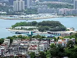
 Tai Lei with Peng Chau in the foreground and the Discovery Bay Marina in the background in July 2010. | |
| Geography | |
| Coordinates | 22°17′21″N 114°01′59″E / 22.2893°N 114.033°E |
| Administration | |
| District | Islands District |
| Demographics | |
| Population | 0 |
| Tai Lei | |||||||||
|---|---|---|---|---|---|---|---|---|---|
| Traditional Chinese | 大利島 | ||||||||
| |||||||||
| Tai Lei Chau | |||||||||
| Traditional Chinese | 大利洲 | ||||||||
| |||||||||

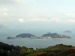
Tai Lei, also referred to as Tai Lei Chau, is a small island located off the island of Peng Chau in Hong Kong. The island is connected to Peng Chau by a bridge. The bridge leading to the island is a popular fishing spot for residents of Peng Chau.
Features
The island houses an electrical substation operated by China Light and Power.[1] In 2010, renovation work conducted on the CLP facility on Tai Lei met resistance from local environmental organisations.[2][3]
Part of the island is occupied by a refuse-sorting facility which handles much of the garbage generated by Peng Chau. The facility is connected to its own pier which allows material to be removed and taken to landfills by ship.[4]
Transportation
.jpg.webp)
The island is connected to Peng Chau by the Peng Lei Road bridge.

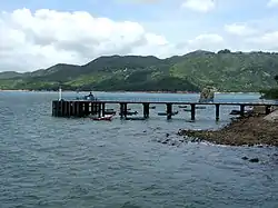
The southern end of the island has a public pier which is operated and maintained by the Civil Engineering and Development Department of the government.[5]
See also
References
- ↑ Wong, Marcus. "Visiting Tai Lei – Peng Chau's boring little brother". Checkerboard Hill. Retrieved 7 May 2019.
- ↑ "Two emails of China Light Power staff, Mr Poon Kin On to Mayling Chan, Advisor of Green Peng Chau Association" (PDF). Green Peng Chau Association. Retrieved 7 May 2019.
- ↑ "Tai Lei Chau China Light Power (CLP) landing point rectification". Green Peng Chau Association. Retrieved 7 May 2019.
- ↑ "Collection Points for Recycling of Peach Blossom Trees" (PDF). Hong Kong Waste Reduction Programme. Environmental Protection Department. Retrieved 7 May 2019.
- ↑ "Public Piers maintained by CEDD". Civil Engineering and Development Department. Government of the Hong Kong Special Administrative Region. Retrieved 7 May 2019.