Tajov | |
|---|---|
Village | |
 | |
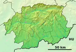 Tajov Location of Tajov in the Banská Bystrica Region  Tajov Tajov (Slovakia) | |
| Coordinates: 48°45′N 19°04′E / 48.750°N 19.067°E | |
| Country | Slovakia |
| Region | Banská Bystrica |
| District | Banská Bystrica |
| First mentioned | 1495 |
| Government | |
| • Mayor | Ladislav Surovčík |
| Area | |
| • Total | 9.28[1] km2 (3.58[1] sq mi) |
| Elevation | 478[2] m (1,568[2] ft) |
| Population (2021) | |
| • Total | 661[3] |
| Postal code | 976 34[2] |
| Area code | +421 48[2] |
| Car plate | BB |
| Website | tajov |
Tajov (Hungarian: Tajó) is a village and municipality in Banská Bystrica District in the Banská Bystrica Region of central Slovakia.[4]
History
In historical records the village was first mentioned in 1495.
Geography
The municipality lies at an altitude of 464 metres and covers an area of 9.289 km². It is situated on outskirts of Banská Bystrica, under the Kremnica Mountains. The village has a population of about 592 people.
Famous people
- Vratislav Greško, football player
- Jozef Murgaš, inventor, pioneer of radiotelegraphy
- Jozef Gregor-Tajovský, writer and playwright[5]
References
- 1 2 "Hustota obyvateľstva - obce [om7014rr_ukaz: Rozloha (Štvorcový meter)]". www.statistics.sk (in Slovak). Statistical Office of the Slovak Republic. 2022-03-31. Retrieved 2022-03-31.
- 1 2 3 4 "Základná charakteristika". www.statistics.sk (in Slovak). Statistical Office of the Slovak Republic. 2015-04-17. Retrieved 2022-03-31.
- ↑ "Počet obyvateľov podľa pohlavia - obce (ročne)". www.statistics.sk (in Slovak). Statistical Office of the Slovak Republic. 2022-03-31. Retrieved 2022-03-31.
- ↑ "Tajov - Okres Banská Bystrica - E-OBCE.sk".
- ↑ "História a súčasnosť obce" [Past and Present of the Village]. tajov.sk (in Slovak). Retrieved 24 April 2021.
External links
 Tajov travel guide from Wikivoyage
- Official website
This article is issued from Wikipedia. The text is licensed under Creative Commons - Attribution - Sharealike. Additional terms may apply for the media files.