Takal | |
|---|---|
Village | |
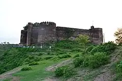
 Nearby Sangni Fort, west of Takal | |
 Takal  Takal | |
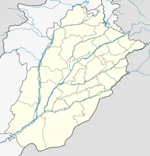
| Coordinates: 33°22′26″N 73°28′05″E / 33.37389°N 73.46806°E | |
| Country | |
| Province | Punjab (Pakistan) |
| District | Rawalpindi |
| Tehsil | Kallar Syedan |
| UC | Choha Khalsa |
| Time zone | UTC+5 (PST) |
Takal is the biggest village in Choha Khalsa Union Council of Kallar Syedan Tehsil, Rawalpindi District of Punjab, Pakistan. Nearby towns include Bewal and Choha Khalsa. The village named after a Sikh – Tikka Lal Singh. It is located about 15 kilometres (9.3 mi) from Kallar Syedan, towards the Jhelum River.
Places of interest
Schools in Takal
- Government Boys Middle School TAKKAL, CHOA KHALSA, KALLAR SYEDAN
References
- ↑ "Sangni Fort". Traveler Trails. Retrieved 2023-09-15.
This article is issued from Wikipedia. The text is licensed under Creative Commons - Attribution - Sharealike. Additional terms may apply for the media files.