Talisay | |
|---|---|
| Municipality of Talisay | |
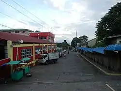 Street in Talisay | |
 Flag  Seal | |
| Nickname(s): Seedling Bowl of Batangas Gateway to the Taal Volcano | |
| Anthem: Talisay Hymn | |
 Map of Batangas with Talisay highlighted | |
OpenStreetMap | |
.svg.png.webp) Talisay Location within the Philippines | |
| Coordinates: 14°06′N 121°01′E / 14.1°N 121.02°E | |
| Country | Philippines |
| Region | Calabarzon |
| Province | Batangas |
| District | 3rd district |
| Founded | February 10, 1869 |
| Annexation to Tanauan | March 28, 1903 |
| Reestablishment | July 23, 1906 |
| Barangays | 21 (see Barangays) |
| Government | |
| • Type | Sangguniang Bayan |
| • Mayor | Nestor D. Natanauan |
| • Vice Mayor | Francis M. Magsino |
| • Representative | Ma. Theresa V. Collantes |
| • Municipal Council | Members |
| • Electorate | 28,981 voters (2022) |
| Area | |
| • Total | 28.20 km2 (10.89 sq mi) |
| Elevation | 227 m (745 ft) |
| Highest elevation | 743 m (2,438 ft) |
| Lowest elevation | 5 m (16 ft) |
| Population (2020 census)[3] | |
| • Total | 46,238 |
| • Density | 1,600/km2 (4,200/sq mi) |
| • Households | 10,785 |
| Economy | |
| • Income class | 3rd municipal income class |
| • Poverty incidence | 10.72 |
| • Revenue | ₱ 178.8 million (2020) |
| • Assets | ₱ 663.3 million (2020) |
| • Expenditure | ₱ 141.8 million (2020) |
| • Liabilities | ₱ 276.2 million (2020) |
| Service provider | |
| • Electricity | Batangas 2 Electric Cooperative (BATELEC 2) |
| Time zone | UTC+8 (PST) |
| ZIP code | 4220 |
| PSGC | |
| IDD : area code | IDD : area code |
| Native languages | Tagalog |
| Website | www |
Talisay, officially the Municipality of Talisay (Tagalog: Bayan ng Talisay), is a 3rd class municipality in the province of Batangas, Philippines. According to the 2020 census, it has a population of 46,238 people.[3]
Etymology
Talisay is derived from a tree of the same name (Terminalia catappa) where the bells of a Catholic parish church were hung. Such church was then a temporary building located at the center of the then-barrio.[5]
History
Talisay traces its roots to a barrio that was once part of Tanauan during the Spanish colonization of the Philippines. In 1754, it was annexed to Taal following the transfer of Tanauan's seat to its present-day barangay Sala as a result of the Taal Volcano eruption that year.[6] Talisay was later formed as a separate municipio on February 10, 1869.[5] However, on March 28, 1903, during the American occupation, it was returned to Tanauan but later separated on July 23, 1906 to regain its independent status.[7][8]
On April 1, 1941, a portion of Talisay, especially its barrios Birinayan (Berinayan) and Caloocan, was ceded to Tagaytay through Executive Order No. 336 signed by President Manuel L. Quezon.[9] Both aforementioned barrios were later returned to Talisay on June 7, 1956.[10]
On June 21, 1969, the barrios of Bayuyungan, Ticub, Balakilong, Bugaan, Borinayan (Berinayan), As-is, San Gabriel, and Buso-buso were separated from Talisay to constitute into a new and separate municipality of Laurel by virtue of Republic Act No. 5689.[11]
Geography
Talisay is located at 14°06′N 121°01′E / 14.1°N 121.02°E, in the north-central area of Batangas which is located south-west of the island of Luzon. Talisay is 56 kilometers (35 mi) from Batangas City and 79 kilometers (49 mi) south from Metro Manila. It is bordered in the north by Tagaytay, west by Laurel, east by Tanauan, and south by a vast volcanic lake called Taal Lake.
According to the Philippine Statistics Authority, the municipality has a land area of 28.20 square kilometers (10.89 sq mi) [12] constituting 0.90% of the 3,119.75-square-kilometer (1,204.54 sq mi) total area of Batangas.
Barangays
Talisay is politically subdivided into 21 barangays.[13] Each barangay consists of puroks and some have sitios.
In 1953, the sitio of Buco in the barrio of Balas was converted into a barangay.[14]
| PSGC | Barangay | Population | ±% p.a. | |||
|---|---|---|---|---|---|---|
| 2020[3] | 2010[15] | |||||
| 041030001 | Aya | 13.4% | 6,215 | 5,523 | 1.19% | |
| 041030003 | Balas | 3.3% | 1,530 | 1,187 | 2.57% | |
| 041030004 | Banga | 8.8% | 4,050 | 3,917 | 0.33% | |
| 041030006 | Buco | 2.2% | 1,005 | 975 | 0.30% | |
| 041030008 | Caloocan | 3.9% | 1,785 | 1,665 | 0.70% | |
| 041030009 | Leynes | 3.2% | 1,473 | 1,387 | 0.60% | |
| 041030010 | Miranda | 4.1% | 1,902 | 1,413 | 3.02% | |
| 041030011 | Poblacion Barangay 1 | 4.2% | 1,921 | 1,781 | 0.76% | |
| 041030012 | Poblacion Barangay 2 | 3.0% | 1,381 | 1,361 | 0.15% | |
| 041030013 | Poblacion Barangay 3 | 1.6% | 728 | 781 | −0.70% | |
| 041030014 | Poblacion Barangay 4 | 2.0% | 928 | 799 | 1.51% | |
| 041030015 | Poblacion Barangay 5 | 0.6% | 265 | 221 | 1.83% | |
| 041030016 | Poblacion Barangay 6 | 8.2% | 3,796 | 2,428 | 4.57% | |
| 041030017 | Poblacion Barangay 7 | 1.1% | 504 | 483 | 0.43% | |
| 041030018 | Poblacion Barangay 8 | 1.6% | 736 | 770 | −0.45% | |
| 041030019 | Quiling | 9.8% | 4,544 | 3,855 | 1.66% | |
| 041030020 | Sampaloc | 9.8% | 4,531 | 3,960 | 1.36% | |
| 041030021 | San Guillermo | 2.3% | 1,066 | 991 | 0.73% | |
| 041030023 | Santa Maria | 3.0% | 1,387 | 1,357 | 0.22% | |
| 041030024 | Tranca | 6.4% | 2,950 | 2,660 | 1.04% | |
| 041030025 | Tumaway | 5.6% | 2,604 | 2,086 | 2.24% | |
| Total | 46,238 | 39,600 | 1.56% | |||
Climate
| Climate data for Talisay, Batangas | |||||||||||||
|---|---|---|---|---|---|---|---|---|---|---|---|---|---|
| Month | Jan | Feb | Mar | Apr | May | Jun | Jul | Aug | Sep | Oct | Nov | Dec | Year |
| Mean daily maximum °C (°F) | 29 (84) |
30 (86) |
31 (88) |
33 (91) |
32 (90) |
30 (86) |
29 (84) |
29 (84) |
29 (84) |
29 (84) |
29 (84) |
29 (84) |
30 (86) |
| Mean daily minimum °C (°F) | 20 (68) |
20 (68) |
21 (70) |
22 (72) |
24 (75) |
24 (75) |
24 (75) |
24 (75) |
24 (75) |
23 (73) |
22 (72) |
21 (70) |
22 (72) |
| Average precipitation mm (inches) | 11 (0.4) |
13 (0.5) |
14 (0.6) |
32 (1.3) |
101 (4.0) |
142 (5.6) |
208 (8.2) |
187 (7.4) |
175 (6.9) |
131 (5.2) |
68 (2.7) |
39 (1.5) |
1,121 (44.3) |
| Average rainy days | 5.2 | 5.0 | 7.4 | 11.5 | 19.8 | 23.5 | 27.0 | 25.9 | 25.2 | 23.2 | 15.5 | 8.3 | 197.5 |
| Source: Meteoblue[16] | |||||||||||||
Demographics
| Year | Pop. | ±% p.a. |
|---|---|---|
| 1903 | 5,657 | — |
| 1918 | 6,986 | +1.42% |
| 1939 | 11,939 | +2.58% |
| 1948 | 12,140 | +0.19% |
| 1960 | 19,834 | +4.17% |
| 1970 | 14,821 | −2.87% |
| 1975 | 16,624 | +2.33% |
| 1980 | 19,447 | +3.19% |
| 1990 | 23,153 | +1.76% |
| 1995 | 26,997 | +2.92% |
| 2000 | 32,465 | +4.03% |
| 2007 | 39,120 | +2.61% |
| 2010 | 39,600 | +0.44% |
| 2015 | 45,301 | +2.59% |
| 2020 | 46,238 | +0.40% |
| Source: Philippine Statistics Authority[17][15][18][19] | ||
In the 2020 census, Talisay had a population of 46,238.[3] The population density was 1,600 inhabitants per square kilometre (4,100/sq mi).
Educational Institutions
A. Primary
- Jorge B. Vargas Memorial Elementary School
- Mcrew Educational Institute
- Caloocan Elementary School
- Santo Agustino Academy
- Balas Elementary School
- Banga Elementary School
- Venancio Trinidad Sr. Memorial Elementary School
- Quiling Elementary School
- Dona Maria Laurel Platon Memorial School.
B. Secondary
- Balas Buco Sta. Maria National High School
- Talisay Polytechnic Institute
- Talisay High School
- Talisay High School Senior High
- San Guillermo Academy
- Talisay Senior High School
Economy
Government
Local government
- Mayor: Nestor D Natanauan
- Vice Mayor: Francis "Patet" Magsino
- Councilors
- Rolly C.Lamano
- Kap.Tess Panghulan
- Sk Pres.Nestor A. Cabrera
- Edgardo Caraan
- Henry De Leon
- Kap.Floring Mainot
- Melody L. Luna
- Felix "Bing" Salazar
Gallery
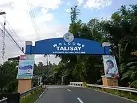 Welcome arch
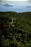 Aerial view
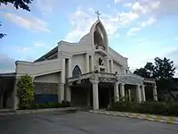 Saint William the Hermit Parish Church
References
- ↑ Municipality of Talisay | (DILG)
- ↑ "2015 Census of Population, Report No. 3 – Population, Land Area, and Population Density" (PDF). Philippine Statistics Authority. Quezon City, Philippines. August 2016. ISSN 0117-1453. Archived (PDF) from the original on May 25, 2021. Retrieved July 16, 2021.
- 1 2 3 4 Census of Population (2020). "Region IV-A (Calabarzon)". Total Population by Province, City, Municipality and Barangay. Philippine Statistics Authority. Retrieved 8 July 2021.
- ↑ "PSA Releases the 2018 Municipal and City Level Poverty Estimates". Philippine Statistics Authority. 15 December 2021. Retrieved 22 January 2022.
- 1 2 "History". Talisay, Batangas. Retrieved July 3, 2023.
- ↑ Hargrove, Thomas (1991). The Mysteries of Taal: A Philippine volcano and lake, her sea life and lost towns. Manila: Bookmark Publishing. pp. 13, 33–55. ISBN 9715690467.
- ↑ Act No. 708 (28 March 1903), "An Act Reducing Thirteen of the Municipalities in the Province of Batangas to Five", Senate of the Philippines Legislative Digital Resources, retrieved July 5, 2023
- ↑ Act No. 1514 (23 July 1906), "An Act Increasing the Number of Municipalities in the Province of Batangas From Fifteen to Sixteen, by Separating From Tanauan the Former Municipality of Talisay, Reconstituting the Latter as a Municipality, and Giving to Each the Territory Which It Comprised Prior to the Passage of Act Numbered Seven Hundred and Eight", Senate of the Philippines Legislative Digital Resources, retrieved July 5, 2023
- ↑ Executive Order No. 336, s. 1941 (1 April 1941), "Defining the Territorial Limits of the City of Tagaytay", Official Gazette of the Philippines, retrieved July 6, 2023
- ↑ Republic Act No. 1418 (7 June 1956), "An Act to Transfer to the Municipality of Talisay, Province of Batangas, Its Former Barrios of Caloocan and Binirayan Which Were Annexed to the City of Tagaytay", Supreme Court E-Library, retrieved July 6, 2023
- ↑ Republic Act No. 5689 (21 June 1969), "An Act Creating the Municipality of Laurel in the Province of Batangas", The Corpus Juris, retrieved July 3, 2023
- ↑ "Province: Batangas". PSGC Interactive. Quezon City, Philippines: Philippine Statistics Authority. Retrieved 12 November 2016.
- ↑ "Municipal: Talisay, Batangas". PSGC Interactive. Quezon City, Philippines: Philippine Statistics Authority. Retrieved 8 January 2016.
- ↑ "An Act to Convert the Sitio of Buco in the Barrio of Balas, Municipality of Talisay, Province of Batangas, into a Barrio". LawPH.com. Retrieved 2011-04-09.
- 1 2 Census of Population and Housing (2010). "Region IV-A (Calabarzon)" (PDF). Total Population by Province, City, Municipality and Barangay. National Statistics Office. Retrieved 29 June 2016.
- ↑ "Talisay: Average Temperatures and Rainfall". Meteoblue. Retrieved 5 May 2020.
- ↑ Census of Population (2015). "Region IV-A (Calabarzon)". Total Population by Province, City, Municipality and Barangay. Philippine Statistics Authority. Retrieved 20 June 2016.
- ↑ Censuses of Population (1903–2007). "Region IV-A (Calabarzon)". Table 1. Population Enumerated in Various Censuses by Province/Highly Urbanized City: 1903 to 2007. National Statistics Office.
{{cite encyclopedia}}: CS1 maint: numeric names: authors list (link) - ↑ "Province of Batangas". Municipality Population Data. Local Water Utilities Administration Research Division. Retrieved 17 December 2016.
- ↑ "Poverty incidence (PI):". Philippine Statistics Authority. Retrieved December 28, 2020.
- ↑ "Estimation of Local Poverty in the Philippines" (PDF). Philippine Statistics Authority. 29 November 2005.
- ↑ "2003 City and Municipal Level Poverty Estimates" (PDF). Philippine Statistics Authority. 23 March 2009.
- ↑ "City and Municipal Level Poverty Estimates; 2006 and 2009" (PDF). Philippine Statistics Authority. 3 August 2012.
- ↑ "2012 Municipal and City Level Poverty Estimates" (PDF). Philippine Statistics Authority. 31 May 2016.
- ↑ "Municipal and City Level Small Area Poverty Estimates; 2009, 2012 and 2015". Philippine Statistics Authority. 10 July 2019.
- ↑ "PSA Releases the 2018 Municipal and City Level Poverty Estimates". Philippine Statistics Authority. 15 December 2021. Retrieved 22 January 2022.
External links
![]() Media related to Talisay, Batangas at Wikimedia Commons
Media related to Talisay, Batangas at Wikimedia Commons
Places adjacent to Talisay, Batangas | ||||||||||||||||
|---|---|---|---|---|---|---|---|---|---|---|---|---|---|---|---|---|
| ||||||||||||||||
| Component cities | |
|---|---|
| Municipalities | |