Tatkavaklı | |
|---|---|
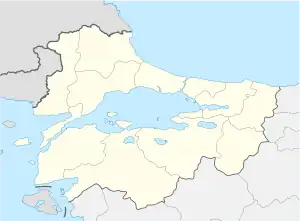
 Tatkavaklı Location in Turkey  Tatkavaklı Tatkavaklı (Marmara) | |
| Coordinates: 40°02′N 28°22′E / 40.033°N 28.367°E | |
| Country | Turkey |
| Province | Bursa |
| District | Mustafakemalpaşa |
| Elevation | 35 m (115 ft) |
| Population (2022) | 5,179 |
| Time zone | TRT (UTC+3) |
| Postal code | 16550 |
| Area code | 0224 |
Tatkavaklı (formerly: Kavaklı) is a neighbourhood of the municipality and district of Mustafakemalpaşa, Bursa Province, Turkey.[1] Its population is 5,179 (2022).[2] Before the 2013 reorganisation, it was a town (belde).[3][4]
Geography
Tatkavaklı is on Turkish state road D.573 which connects Bursa to İzmir. Its distance to Mustafakemalpaşa is 4 kilometres (2.5 mi) and to Bursa is 89 kilometres (55 mi).
History
The settlement was founded by a group of families migrated from Kangal (Sivas Province, east of Central Anatolia) in the early 16th century. The first building of the settlement was a mosque commissioned by Sipahi Kapucu a tımarlı sipahi (fief holder) of the Ottoman Empire in 1505. The earlier name of the settlement was Kavaklı ("with poplar") . But in 1973 when the settlement was declared a seat of township, the prefix Tat was added referring to a factory around.[5]
Economy
The economy of the town depends on agriculture. There is a tomato paste factory and a dairy products factory around the town.
References
- ↑ Mahalle, Turkey Civil Administration Departments Inventory. Retrieved 12 July 2023.
- ↑ "Address-based population registration system (ADNKS) results dated 31 December 2022, Favorite Reports" (XLS). TÜİK. Retrieved 12 July 2023.
- ↑ "Law No. 6360". Official Gazette (in Turkish). 6 December 2012.
- ↑ "Classification tables of municipalities and their affiliates and local administrative units" (DOC). Official Gazette (in Turkish). 12 September 2010.
- ↑ Mayor's page (in Turkish) Archived 2013-04-18 at archive.today