Taxila Tehsil | |
|---|---|
 | |
| Country | Pakistan |
| Region | Punjab |
| District | Rawalpindi District |
| Capital | Taxila |
| Union councils | 10 |
| Population (2017) | |
| • Total | 677,951 |
| Time zone | UTC+5 (PST) |
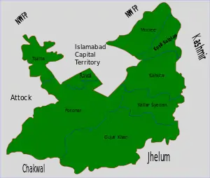
The Taxila Tehsil, with its administrative centre in Taxila, is one of the eight districts of the Rawalpindi District in the Punjab, Pakistan. The Attock District, Rawalpindi Tehsil, Islamabad Capital Territory, and Haripur District surround it on the north and west.
The area was part of the ancient Gandhara region. Taxila was designated a UNESCO World Heritage Site in 1980 and is located in the town of Taxila.[1]

Union Councils of Taxila Tehsil.
Demographics
As per the 2017 census, the Tehsil (district) has a population of 677,951.[2]
Administration
The Taxila area is divided into ten union councils.[3]
- Ghari Sikander
- Khurram Paracha
- Lab Thatoo
- Taxila Urban (3 Unions)
- Thatha Khalil
- Usman Khattar
- Wah
- Garhi Afghanan
References
- ↑ UNESCO World Heritage Site, 1980. Taxila: Multiple Locations
- ↑ Pakistan Bureau of Statistics
- ↑ "Zila, Tehsil & Town Councils Membership for Punjab". Election Commission of Pakistan website. Archived from the original on 4 March 2009. Retrieved 29 September 2021.
This article is issued from Wikipedia. The text is licensed under Creative Commons - Attribution - Sharealike. Additional terms may apply for the media files.