| Telford Victoria | |||||||||||||||
|---|---|---|---|---|---|---|---|---|---|---|---|---|---|---|---|
 Telford | |||||||||||||||
| Coordinates | 36°05′56″S 145°55′52″E / 36.09889°S 145.93111°E | ||||||||||||||
| Population | 24 [1]2016 census | ||||||||||||||
| Postcode(s) | 3730 | ||||||||||||||
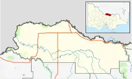
| LGA(s) | Shire of Moira | ||||||||||||||
| State electorate(s) | Ovens Valley | ||||||||||||||
| Federal division(s) | Nicholls | ||||||||||||||
| |||||||||||||||
Telford is a locality in Victoria on the Oaklands railway line, Victoria.
Transport
It is served by a wheat silo. The branchline is now freight only and no longer carries passenger trains.
See also
References
- ↑ "2016 Telford, Census All persons QuickStats | Australian Bureau of Statistics". abs.gov.au. Retrieved 25 May 2022.
Localities in the Shire of Moira | ||
|---|---|---|
| Town | ||
| Locality |
| |
^ - Territory divided with another LGA | ||
This article is issued from Wikipedia. The text is licensed under Creative Commons - Attribution - Sharealike. Additional terms may apply for the media files.