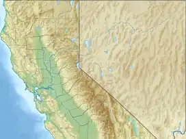
| The Inkwells | |
|---|---|
| Shafters (upper) Hole (lower) | |
 The upper Inkwell | |
 The Inkwells | |
| Location | Marin County, California |
| Coordinates | 38°00′17″N 122°42′32″W / 38.004831°N 122.708891°W |
| Part of | Tomales Bay Watershed |
| Primary inflows | Lagunitas Creek, San Geronimo Creek |
| Primary outflows | Lagunitas Creek |
| Surface elevation | 53 metres (174 ft) |
| References | [1] |
The Inkwells (also known as The Ink Wells) are two deep natural swimming pools in Lagunitas Creek, in Marin County, California.[2] The upper Inkwell is also known as "Shafters", named after the former railroad bridge that bore its name nearby, whereas the lower Inkwell is simply known as "Inkwell" or "Hole" because it is deeper and darker. Together, they are known as "The Inkwells". They are a common swimming spot in summer, despite failing to meet current water quality standards due to high levels of coliform.[3][4] The Inkwells are accessible by car as well as public transit, with a Marin Transit bus stop being less than a mile away.[5] The Inkwells Bridge, which runs above the inkwells, is part of the Bay Area Ridge Trail. It also carries pipes that bring water from nearby Kent Lake and the nearby Nicasio Reservoir to be treated.[6]
References
- ↑ "Elevation Finder". www.freemaptools.com. Retrieved 10 April 2023.
- ↑ "Swim at the Inkwells". www.theoutbound.com. Retrieved 2022-04-18.
- ↑ "Inkwells". Swim Guide. Swim Drink Fish Canada.
- ↑ Houston, Will (12 July 2020). "Marin County beaches receive 'outstanding' water quality ratings". Marin Independent Journal. Retrieved 10 April 2023.
- ↑ "Ink Wells to Sir Francis Drake Blvd & W Cintura Av". Ink Wells to Sir Francis Drake Blvd & W Cintura Av. Retrieved 2022-04-18.
- ↑ Hall, Catie (6 May 2009). "The Seven Wonders of Marin: The Inkwells". The Seven Wonders of Marin. Retrieved 10 April 2023.