Thung Saliam
ทุ่งเสลี่ยม | |
|---|---|
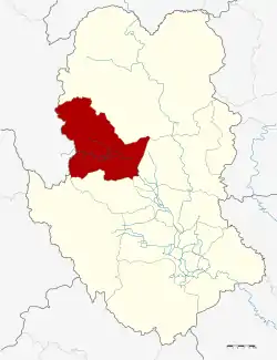 District location in Sukhothai province | |
| Coordinates: 17°19′15″N 99°33′39″E / 17.32083°N 99.56083°E | |
| Country | Thailand |
| Province | Sukhothai |
| Seat | Thung Saliam |
| Area | |
| • Total | 569.932 km2 (220.052 sq mi) |
| Population (2009) | |
| • Total | 49,962 |
| • Density | 87.66/km2 (227.0/sq mi) |
| Time zone | UTC+7 (ICT) |
| Postal code | 64150 |
| Geocode | 6409 |
Thung Saliam (Thai: ทุ่งเสลี่ยม, pronounced [tʰûŋ sā.lìa̯m]) is a district (amphoe) of Sukhothai province, in the lower north of Thailand.[1][2]
Geography
Neighboring districts are (from the north clockwise): Si Satchanalai, Sawankhalok, Si Samrong and Ban Dan Lan Hoi of Sukhothai Province, and Thoen of Lampang province.
History
The minor district (king amphoe) Thung Saliam was established in 1957, when the two tambons Thung Saliam and Klang Dong were split off from Sawankhalok District.[3] It was upgraded to a full district in 1959.[4]
Its name Thung Saliam literally means "field of Indian lilacs", because there used to be this kind of mahogany that used to grow abundantly in the area.
Administration
The district is divided into five sub-districts (tambons), which are further subdivided into 59 villages (mubans). The sub-district municipality (thesaban tambon) Thung Saliam covers parts of tambon Thung Saliam, and Khao Kaeo Si Sombun the entire sub-district of the same name. There are a further four tambon administrative organizations (TAO).
| No. | Name | Thai | Villages | Pop.[5] |
|---|---|---|---|---|
| 1. | Ban Mai Chai Mongkhon | บ้านใหม่ไชยมงคล | 9 | 7,179 |
| 2. | Thai Chana Suek | ไทยชนะศึก | 11 | 8,274 |
| 3. | Thung Saliam | ทุ่งเสลี่ยม | 13 | 14,303 |
| 4. | Klang Dong | กลางดง | 15 | 12,207 |
| 5. | Khao Kaeo Si Sombun | เขาแก้วศรีสมบูรณ์ | 11 | 7,999 |
References
- ↑ "ข้อมูลทั่วไป". Archived from the original on 2020-01-27.
- ↑ "Tourism Investment Geo-Informatic Systems - Tourism Investment Geo-Informatic Systems". tourisminvest.tat.or.th. Archived from the original on 30 March 2016. Retrieved 22 May 2022.
- ↑ ประกาศกระทรวงมหาดไทย เรื่อง ยกฐานะตำบลขึ้นเป็นกิ่งอำเภอ (PDF). Royal Gazette (in Thai). 74 (51 ง): 1281–1282. June 4, 1957. Archived from the original (PDF) on May 16, 2012.
- ↑ พระราชกฤษฎีกาตั้งอำเภอชุมพวง อำเภอเชียงยืน อำเภอแก้งคร้อ อำเภอสำโรงทาบ อำเภอคอนสาร อำเภอเซกา อำเภอทุ่งเสลี่ยม อำเภอบ้านด่าน อำเภอขนอม อำเภอบ้านแพรก อำเภอกระทู้ และอำเภอคลองใหญ่ พ.ศ. ๒๕๐๒ (PDF). Royal Gazette (in Thai). 76 (113 ก ฉบับพิเศษ): 8. January 10, 1959. Archived from the original (PDF) on July 18, 2011.
- ↑ "Population statistics 2009". Department of Provincial Administration. Archived from the original on 2016-03-05. Retrieved 2010-09-19.
External links
- amphoe.com (Thai)
.svg.png.webp) | ||