Trafalgar | |
|---|---|
 Trafalgar Beach | |
 Trafalgar  Trafalgar | |
| Coordinates: 30°57′29″S 30°17′31″E / 30.958°S 30.292°E | |
| Country | South Africa |
| Province | KwaZulu-Natal |
| District | Ugu |
| Municipality | Ray Nkonyeni |
| Main Place | Southbroom |
| Area | |
| • Total | 2.63 km2 (1.02 sq mi) |
| Population (2011)[1] | |
| • Total | 397 |
| • Density | 150/km2 (390/sq mi) |
| Racial makeup (2011) | |
| • Black African | 21.4% |
| • Coloured | 0.5% |
| • White | 78.1% |
| First languages (2011) | |
| • English | 50.6% |
| • Afrikaans | 35.3% |
| • Zulu | 6.5% |
| • Xhosa | 3.5% |
| • Other | 4.0% |
| Time zone | UTC+2 (SAST) |
| PO box | 4275 |
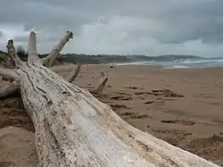
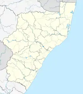
Trafalgar is a seaside resort village in Ugu District Municipality in the KwaZulu-Natal province of South Africa. Trafalgar is on the north bank of the Mpenjati river which enters the Indian Ocean at the Mpenjati Nature Reserve. The beach at Mpenjati Nature Reserve has been used by naturists for many years.
Transport
Trafalgar can be accessed by turning off the R61 (to Port Edward and Port Shepstone) onto Trafalgar Drive, the single access road into village.
References
- 1 2 3 4 "Sub Place Trafalgar". Census 2011.
This article is issued from Wikipedia. The text is licensed under Creative Commons - Attribution - Sharealike. Additional terms may apply for the media files.
.svg.png.webp)