Trevinano | |
|---|---|
 | |
.png.webp) Trevinano (blue spot) within the municipality of Acquapendente (orange) and the province | |
 Trevinano Location of Trevinano in Italy | |
| Coordinates: 42°49′22.01″N 11°52′14.16″E / 42.8227806°N 11.8706000°E | |
| Country | |
| Region | |
| Province | Viterbo (VT) |
| Comune | Acquapendente |
| Elevation | 619 m (2,031 ft) |
| Population (2011)[1] | |
| • Total | 142 |
| Demonym | Trevinanesi |
| Time zone | UTC+1 (CET) |
| • Summer (DST) | UTC+2 (CEST) |
| Postal code | 01021 |
| Dialing code | (+39) 0763 |
| Website | Trevinano info website |
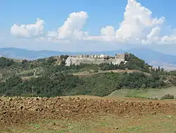
Trevinano is an Italian village, frazione of Acquapendente, in the Province of Viterbo, northern Lazio. As of 2011, its population was of 142.[1]
History
The village was part of a territory anciently settled by the Etruscans.[2] Between 1500 and 1800 it was an autonomous municipality, not part of Acquapendente.[3]
Geography
Located upon a hill near the borders of Lazio with the province of Siena (Tuscany) and Terni (Umbria), Trevinano is the northernmost settlement of its region.[4] It is situated near the Tuscan Lake of San Casciano, in the nearby municipality of San Casciano dei Bagni (9 km far). It is 12 km far from Allerona, 14 from Acquapendente, 30 from Orvieto, 33 from Bolsena and 65 from Viterbo.[5][6]
Near the village flows a little river named Rio Tirolle and in the east of it is located the Monte Rufeno Natural Reserve.
Main sights
Gallery
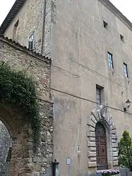
 The Castle of Trevinano (1)
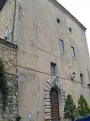
 The Castle of Trevinano (2)
References
- 1 2 (in Italian) Info on italia.indettaglio.it
- ↑ (in Italian) History of Trevinano
- ↑ (in Italian) The ancient municipality of Trevinano
- ↑ Source: Strade d'Italia - Atlas of the Geographic Institute De Agostini
- ↑ (in Italian) Overview of the village of Trevinano
- ↑ 410177175 Trevinano on OpenStreetMap
- ↑ (in Italian) Castle of Trevinano website
- ↑ (in Italian) The "Madonna della Quercia" of Trevinano website
- ↑ (in Italian) The parish church of Trevinano on the Italian Yellow Pages
External links
- (in Italian) Trevinano info website
- (in Italian) Info about the frazioni of Acquapendente