Tri-County Regional Airport | |||||||||||||||
|---|---|---|---|---|---|---|---|---|---|---|---|---|---|---|---|
| Summary | |||||||||||||||
| Airport type | Public | ||||||||||||||
| Owner | Sauk, Iowa & Richland Counties | ||||||||||||||
| Serves | Lone Rock, Wisconsin | ||||||||||||||
| Time zone | CST (UTC−06:00) | ||||||||||||||
| • Summer (DST) | CDT (UTC−05:00) | ||||||||||||||
| Elevation AMSL | 717 ft / 219 m | ||||||||||||||
| Coordinates | 43°12′43″N 090°10′47″W / 43.21194°N 90.17972°W | ||||||||||||||
| Map | |||||||||||||||
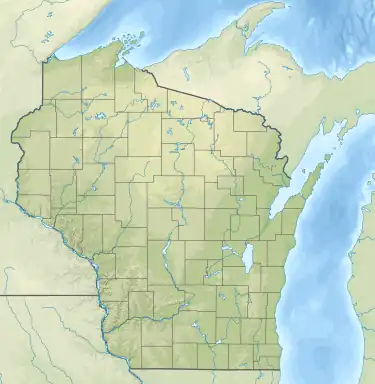 LNR Location of airport in Wisconsin  LNR LNR (the United States) | |||||||||||||||
| Runways | |||||||||||||||
| |||||||||||||||
| Statistics | |||||||||||||||
| |||||||||||||||
Tri-County Regional Airport (IATA: LNR[2], ICAO: KLNR, FAA LID: LNR) is a public use airport in Sauk County, Wisconsin, United States.[1] It is located two nautical miles (4 km) north of the central business district of Lone Rock,[1] a village in Richland County, Wisconsin.[3][4] The airport is owned by the Wisconsin counties of Sauk, Iowa and Richland.[1] It is included in the Federal Aviation Administration (FAA) National Plan of Integrated Airport Systems for 2021–2025, in which it is categorized as a local general aviation facility.[5]
Facilities and aircraft
Tri-County Regional Airport covers an area of 225 acres (90 ha) at an elevation of 717 feet (219 m) above mean sea level. It has two runways with asphalt surfaces: 9/27 is 5,000 by 75 feet (1,524 x 23 m) and 18/36 is 1,850 by 60 feet (564 x 18 m).[1]
For the 12-month period ending September 26, 2022, the airport had 16,000 aircraft operations, an average of 44 per day: 96% general aviation, 3% air taxi and 1% military. In December 2023, there were 27 aircraft based at this airport: 26 single-engine and 1 jet.[1]

See also
References
- 1 2 3 4 5 6 FAA Airport Form 5010 for LNR PDF. Federal Aviation Administration. effective December 28, 2023.
- ↑ "Airline and Airport Code Search (LNR – Airport: Tri-County, City: Lone Rock)". International Air Transport Association (IATA). Retrieved May 16, 2013.
- ↑ "Towns and villages in Richland County". Richland County, Wisconsin. Retrieved May 16, 2013.
- ↑ "Map showing airport, villages of Lone Rock (Richland Co.) and Spring Green (Sauk Co.), and county borders". MapQuest. Retrieved May 16, 2013.
- ↑ "NPIAS Report 2019-2023 Appendix A" (PDF). Federal Aviation Administration. October 3, 2018. Retrieved October 12, 2018.
External links
- Tri-County Regional Airport at Sauk County web site
- "Tri-County Regional (LNR)" (PDF). Archived from the original (PDF) on 2006-09-23. (126 KB) at Wisconsin DOT Airport Directory
- Aerial image as of May 1992 from USGS The National Map
- FAA Terminal Procedures for LNR, effective December 28, 2023
- Resources for this airport:
- FAA airport information for LNR
- AirNav airport information for KLNR
- FlightAware airport information and live flight tracker
- NOAA/NWS weather observations: current, past three days
- SkyVector aeronautical chart, Terminal Procedures
Civil aviation in Wisconsin | ||
|---|---|---|
| Primary airports | ||
| Airlines | ||
| Museums | ||
| Aviation related | ||
| People | ||