| Troublesome Creek Tributary to Haw River | |
|---|---|
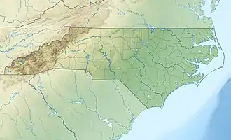
 Location of Troublesome Creek mouth  Troublesome Creek (Haw River tributary) (the United States) | |
| Location | |
| Country | United States |
| State | North Carolina |
| County | Rockingham Guilford |
| City | Stokesdale |
| Physical characteristics | |
| Source | divide between Troublesome Creek and Belews Creek |
| • location | Stokesdale, North Carolina |
| • coordinates | 36°14′49″N 079°59′37″W / 36.24694°N 79.99361°W[1] |
| • elevation | 960 ft (290 m)[2] |
| Mouth | Haw River |
• location | about 5 miles south of Reidsville, North Carolina |
• coordinates | 36°15′57″N 079°38′35″W / 36.26583°N 79.64306°W[1] |
• elevation | 653 ft (199 m)[2] |
| Length | 23.67 mi (38.09 km)[3] |
| Basin size | 55.96 square miles (144.9 km2)[4] |
| Discharge | |
| • location | Haw River |
| • average | 65.59 cu ft/s (1.857 m3/s) at mouth with Haw River[4] |
| Basin features | |
| Progression | Haw River → Cape Fear River → Atlantic Ocean |
| River system | Haw River |
| Tributaries | |
| • left | unnamed tributaries |
| • right | unnamed tributaries |
| Waterbodies | Lake Reidsville |
| Bridges | NC 68, US 220, Price Mill Road, Haynes Road, Hudson Road, Witty Road, Woolen Store Road, Monroeton Road, US 158, McCoy Road, US 29 Business, US 29 |
Troublesome Creek is a 23.67 mi (38.09 km) long 3rd order tributary to the Haw River, in Rockingham County, North Carolina.
Variant names
According to the Geographic Names Information System, it has also been known historically as:[1]
- Big Troublesome Creek
History
Troublesome Creek was the location of Native American activity (Cheraw Indians)[5] in the Middle Archaic period and may have been the location of the first European settlement in Rockingham County, North Carolina.[6] The watershed was the site of the Troublesome Creek Iron Works, also known as Speedwell Furnace. Established in 1770, it is considered one of the earliest colonial ironworks.[7] General Nathaniel Greene also camped here during the Guilford Courthouse campaign in 1781.[8] President George Washington also later visited the ironworks in 1791.[8]
Course
Troublesome Creek rises in the City of Stokesdale in Guilford County on the divide between Troublesome Creek and Belews Creek (Dan River). Troublesome Creek then flows northeast into Rockingham County and then southeast to meet the Haw River about 5 miles south of Reidsville, North Carolina.[2] Lake Reidsville is an impoundment of this stream.
Watershed
Troublesome Creek drains 55.96 square miles (144.9 km2) of area, receives about 46.5 in/year of precipitation, has a topographic wetness index of 426.23 and is about 42% forested.[4]
Natural History
The Rockingham County Natural Heritage Inventory[9] recognized three locations in the Troublesome Creek watershed, all of which are county significant. These include 1) Bottomlands of Troublesome Creek, 2) Troublesome Creek Marsh, and 3) Warf Airfield Marsh.
See also
References
- 1 2 3 "GNIS Detail - Troublesome Creek". geonames.usgs.gov. US Geological Survey. Retrieved 6 October 2019.
- 1 2 3 "Troublesome Creek Topo Map, Rockingham County NC (Reidsville Area)". TopoZone. Locality, LLC. Retrieved 6 October 2019.
- ↑ "ArcGIS Web Application". epa.maps.arcgis.com. US EPA. Retrieved 6 October 2019.
- 1 2 3 "Troublesome Creek Watershed Report". Waters Geoviewer. US EPA. Retrieved 6 October 2019.
- ↑ "Rockingham County (1785)". North Carolina History Project. John Locke Foundation. Retrieved 8 October 2019.
- ↑ "A Landscape Analysis and Cultural Resource Inventory of Troublesome Creek Ironworks: A Geographical and Archeological Approach" (PDF). NC Docks. UNC-Greensboro. Retrieved 8 October 2019.
- ↑ Writer, Carla Bagley Staff. "troublesome history". Greensboro News and Record. Greensboro News and Record. Retrieved 8 October 2019.
- 1 2 "Troublesome Creek". Piedmont Trails. Piedmont Trails North Carolina Forum. 16 October 2017. Retrieved 8 October 2019.
- ↑ Coomans, R.J.; Bates, Ramona C. "Rockingham County natural heritage inventory :: State Publications". cdm16062.contentdm.oclc.org. NC Natural Heritage Program. Retrieved 8 October 2019.
External links
- Historic Marker about Troublesome Iron Works
- Piedmont Trails Article on Troublesome Creek
- Master Thesis on Troublesome Creek Ironworks "A LANDSCAPE ANALYSIS AND CULTURAL RESOURCE INVENTORY OF TROUBLESOME CREEK IRONWORKS: A GEOGRAPHICAL AND ARCHAEOLOGICAL APPROACH"