Trudel | |
|---|---|
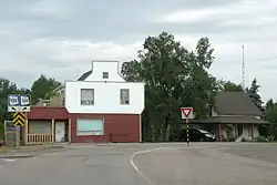 Intersection of Routes 135 and 325 | |
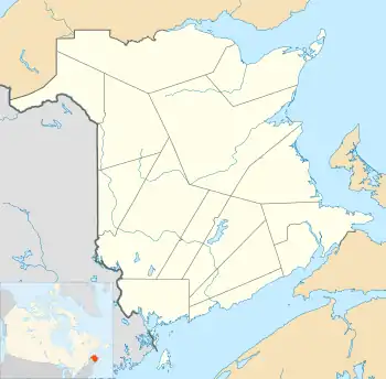 Trudel Location of Trudel within New Brunswick. | |
| Coordinates: 47°41′32″N 65°08′04″W / 47.6923°N 65.1345°W | |
| Country | |
| Province | |
| County | Gloucester County |
| Parish | Paquetville Parish |
| Incorporated | 1904 |
| Government | |
| • Type | Municipal council |
| Population (2011) | |
| • Total | 2,505 |
| Time zone | UTC−4 (Atlantic (AST)) |
| • Summer (DST) | UTC−3 (Atlantic Daylight Time (ADT)) |
| Canadian Postal code | |
| Area code | 506 |
Trudel is a Canadian community in Gloucester County, New Brunswick.
The community is located on the Acadian Peninsula. The community is centred around the intersection of Route 135 and Route 325. Trudel lies about 2 kilometres north of Paquetville
History
Notable people
See also
References
Subdivisions of New Brunswick | |
|---|---|
| Cities | |
| Towns |
|
| Villages | |
| Regional municipality | |
| Rural communities | |
| Rural districts |
|
| Other administrative divisions | |
| |
This article is issued from Wikipedia. The text is licensed under Creative Commons - Attribution - Sharealike. Additional terms may apply for the media files.