Gloucester | |
|---|---|
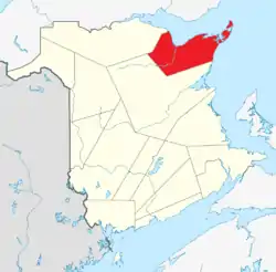 Location within New Brunswick. | |
| Country | Canada |
| Province | New Brunswick |
| Established | 1826 |
| Area | |
| • Land | 4,743.67 km2 (1,831.54 sq mi) |
| Population (2016)[1] | |
| • Total | 78,444 |
| • Density | 16.5/km2 (43/sq mi) |
| • Change 2011-2016 | |
| • Dwellings | 38,789 |
| Time zone | UTC-4 (AST) |
| • Summer (DST) | UTC-3 (ADT) |
| Area code | 506 |
Gloucester County (2016 population 78,444[1]) is located in the northeastern corner of New Brunswick, Canada.[2] Fishing, mining and forestry are the major industries in the county. The eastern section of the county is known for its Acadian culture. The county is named for Princess Mary, Duchess of Gloucester and Edinburgh.[3]
Census subdivisions
Communities
There are nineteen municipalities within the county (listed by 2016 population):[4]
| Official Name | Designation | Area km2 | Population | Parish |
|---|---|---|---|---|
| Bathurst | City | 92.04 | 11,897 | Bathurst |
| Tracadie-Sheila | Town (dissolved) | 24.65 | 5,171 | Saumarez |
| Beresford | Town | 19.41 | 4,288 | Beresford |
| Caraquet | Town | 68.35 | 4,248 | Caraquet |
| Shippagan | Town | 10.02 | 2,580 | Shippagan |
| Petit-Rocher | Village | 4.52 | 1,897 | Beresford |
| Belledune | Village | 189.47 | 1,417 | Beresford |
| Bas-Caraquet | Village | 31.01 | 1,305 | Caraquet |
| Lamèque | Town | 12.51 | 1,285 | Shippagan |
| Bertrand | Village | 57.44 | 1,166 | Caraquet |
| Nigadoo | Village | 7.65 | 963 | Beresford |
| Grande-Anse | Village | 24.33 | 899 | New Bandon |
| Pointe-Verte | Village | 13.79 | 886 | Beresford |
| Sainte-Marie-Saint-Raphaël | Village | 15.90 | 879 | Shippagan |
| Le Goulet | Village | 5.49 | 793 | Shippagan |
| Saint-Isidore | Village | 22.94 | 764 | Saint-Isidore |
| Paquetville | Village | 9.26 | 720 | Paquetville |
| Saint-Léolin | Village | 19.73 | 647 | New Bandon |
| Maisonnette | Village | 12.90 | 495 | New Bandon |
First Nations
There is one First Nations reservation in Gloucester County (listed with 2016 population):[4]
| Official Name | Designation | Area km2 | Population | Parish |
|---|---|---|---|---|
| Pabineau 11 | Reservation | 4.92 | 134 | Bathurst |
Parishes
The county is subdivided into ten parishes (listed by 2016 population):[4]
| Official Name | Area km2 | Population | Municipalities | Unincorporated communities |
|---|---|---|---|---|
| Saumarez | 326.78 | 6,618 | Tracadie-Sheila (town) | Benoit / Charnisay / Commeau / Ferguson Point / Gauvreau / Haut-Sheila / Leech / Little Gaspereau / Losier Settlement / Petit-Tracadie / Pointe-à-Bouleau / Pont-Lafrance / Rivière-à-la-truite / Saint Irénée and Alderwood / Saint-Isidore Station / Saint-Pons / Saumarez / St. Pierre / Tracadie Beach / Val-Comeau |
| Beresford | 456.86 | 6,248 | Beresford (town) Petit-Rocher (village) Belledune (village) Nigadoo (village) Pointe-Verte (village) |
Alcida and Dauversière / Dempsey Settlement / Devereaux / Dunlop / Free Grant / LaPlante / Lincour / Madran / Massabielle / Nicholas-Denys / Robertville / Saint-Laurent / Sainte-Louise / Sainte-Rosette / Sormany / St. George / Tremblay / Val-Michaud |
| Shippegan | 208.08 | 4,800 | Shippagan (town) Lamèque (town) Le Goulet (village) Ste-Marie-St-Raphaël (village) |
Cap-Bateau / Chiasson-Savoy / Coteau Road / Haut-Lamèque / Haut-Shippagan / Herring Point / Miscou Centre / Miscou Harbour / Miscou Lighthouse / Miscou Plains / Petite-Lamèque / Petite-Rivière-de-l'lle / Petit-Shippagan / Pigeon Hill / Pointe-Alexandre / Pointe-Brûlé / Pointe-Canot / Sainte-Cécile / Shippagan Portage / Wilson Point |
| Bathurst | 1504.87 | 4,797 | Bathurst (city) Pabineau 11 (reservation) |
Bartibog Station / Bathurst Mines / Big Antler / Big Moose / Big River / Blue Mountain Settlement / Bruce / Brunswick Mines / Chamberlain Settlement / Goodwin Mill / Gloucester Junction / Hachey Siding / Lawson Brook Siding / Miller Brook / Nepisiguit Junction / North Tetagouche / Ottawa Road / Pitre Road / Red Pine / Rio Grande / Russell / Salmon Beach / South Tetagouche / Tetagouche Hill / Upper Rosehill |
| Inkerman | 107.56 | 2,366 | Boudreau Road / Cowans Creek / Evangeline / Four Roads / Gaspereau / Haché Road / Haut Pokemouche / Inkerman / Inkerman Ferry / Landry / Maltampec / Pokemouche / Pokemouche Junction / Sainte-Rose-Gloucester / Six Roads | |
| Paquetville | 220.51 | 2,329 | Paquetville (village) | Burnsville / Notre-Dame-des-Érables / Petit-Paquetville / Rang-Saint-Georges / Saint-Amateur / Trudel / Val-Doucet |
| Allardville | 654.69 | 2,032 | Allardville / Allardville East / Veniot / Bear Landing / Beaubois / Butte-d'Or / Daulnay / Goodwin Mill / Jeanne-Mance / Saint-Sauveur | |
| Saint-Isidore | 173.25 | 1,361 | Saint-Isidore (village) | Bois-Blanc / Bois-Gagnon / Boishébert / Duguayville / Hacheyville / Haut-Saint-Isidore / Haut Tilley Road / Pokemouche Landing / Pont-Landry / Spruce Brook / Tilley Road |
| Caraquet | 109.97 | 1,337 | Caraquet (town) Bas-Caraquet (village) Bertrand (village) |
Blanchard Settlement / Caraquet Island / Haut-Saint-Simon / Marsoliau / Pokesudie / Saint-Simon / Saint-Simon Centre |
| New Bandon | 359.11 | 1,214 | Grande-Anse (village) Maisonnette (village) Saint-Léolin (village) |
Anse-Bleue / Bertrand Station / Black Rock / Canobie / Clifton / Dugas / Janeville / Johnson / Lobster Beach / New Bandon-Salmon Beach / Pokeshaw / Rocheville / Springfield / Stonehaven / Village-des-Poirier / Village-Saint-Paul / Waterloo Settlement |
Demographics
| Year | Pop. | ±% |
|---|---|---|
| 1991 | 87,613 | — |
| 1996 | 87,601 | −0.0% |
| 2001 | 82,929 | −5.3% |
| 2006 | 78,948 | −4.8% |
| 2011 | 77,792 | −1.5% |
| 2011 rev | 79,943 | +2.8% |
| 2016 | 78,444 | −1.9% |
| The 2011 population count was revised[5][1] | ||
As a census division in the 2021 Census of Population conducted by Statistics Canada, Gloucester County had a population of 78,256 living in 35,830 of its 39,145 total private dwellings, a change of -0.2% from its 2016 population of 78,444. With a land area of 4,734.3 km2 (1,827.9 sq mi), it had a population density of 16.5/km2 (42.8/sq mi) in 2021.[6]
| 2021 | 2016 | 2011 | |
|---|---|---|---|
| Population | 78,256 (-0.2% from 2016) | 78,444 (+0.8% from 2011) | 77,792 (-1.5% from 2006) |
| Land area | 4,734.30 km2 (1,827.92 sq mi) | 4,743.67 km2 (1,831.54 sq mi) | 4,675.21 km2 (1,805.11 sq mi) |
| Population density | 16.5/km2 (43/sq mi) | 16.5/km2 (43/sq mi) | 16.6/km2 (43/sq mi) |
| Median age | 53.6 (M: 52.8, F: 54.0) | 51.1 (M: 50.5, F: 51.6) | 47.9 (M: 47.4, F: 48.4) |
| Private dwellings | 39,145 (total) 35,830 (occupied) | 38,789 (total) | 36,482 (total) |
| Median household income | $60,800 | $52,793 | $46,728 |
Language
| Canada Census Mother Tongue - Gloucester County, New Brunswick[5] | ||||||||||||||||||
|---|---|---|---|---|---|---|---|---|---|---|---|---|---|---|---|---|---|---|
| Census | Total | French |
English |
French & English |
Non-official languages | |||||||||||||
| Year | Responses | Count | Trend | Pop % | Count | Trend | Pop % | Count | Trend | Pop % | Count | Trend | Pop % | |||||
2016 |
77,065 |
64,890 | 84.20% | 10,795 | 14.01% | 810 | 1.05% | 220 | 0.28% | |||||||||
2011 |
76,515 |
64,270 | 84.00% | 11,105 | 14.51% | 745 | 0.97% | 395 | 0.52% | |||||||||
2006 |
77,675 |
65,210 | 83.95% | 11,165 | 14.37% | 625 | 0.80% | 675 | 0.87% | |||||||||
2001 |
81,760 |
68,440 | 83.71% | 12,255 | 14.99% | 845 | 1.03% | 220 | 0.27% | |||||||||
1996 |
86,620 |
72,060 | n/a | 83.19% | 13,545 | n/a | 15.64% | 780 | n/a | 0.90% | 235 | n/a | 0.27% | |||||
Access Routes
Highways and numbered routes that run through the county, including external routes that start or finish at the county limits:[11]
|
Protected areas and attractions
Notable people
See also
References
- 1 2 3 4 "Census Profile, 2016 Census: Gloucester, County [Census division], New Brunswick". Statistics Canada. Retrieved September 8, 2019.
- ↑ New Brunswick Provincial Archives - Gloucester County
- ↑ "Gloucester County", Place Names of New Brunswick: Where is Home? New Brunswick Communities Past and Present, Provincial Archives of New Brunswick, retrieved August 13, 2023
- 1 2 3 4 "2016 Community Profiles". 2016 Canadian Census. Statistics Canada. August 12, 2021. Retrieved September 8, 2019.
- 1 2 Statistics Canada: 1996, 2001, 2006, 2011 census
- ↑ "Population and dwelling counts: Canada and census divisions". Statistics Canada. February 9, 2022. Retrieved April 3, 2022.
- ↑ "2021 Community Profiles". 2021 Canadian Census. Statistics Canada. February 4, 2022. Retrieved October 19, 2023.
- ↑ "2011 Community Profiles". 2011 Canadian Census. Statistics Canada. March 21, 2019. Retrieved March 28, 2014.
- ↑ "2006 Community Profiles". 2006 Canadian Census. Statistics Canada. August 20, 2019.
- ↑ "2001 Community Profiles". 2001 Canadian Census. Statistics Canada. July 18, 2021.
- ↑ Atlantic Canada Back Road Atlas ISBN 978-1-55368-618-7
External links
Places adjacent to Gloucester County, New Brunswick | |
|---|---|
Subdivisions of New Brunswick | |
|---|---|
| Cities | |
| Towns |
|
| Villages | |
| Regional municipality | |
| Rural communities | |
| Rural districts |
|
| Other administrative divisions | |
| |