| Tugur | |
|---|---|
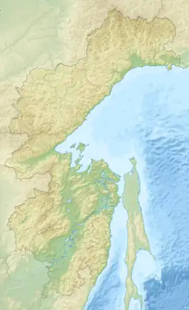 Mouth location in Khabarovsk Krai, Russia | |
| Native name | Тугур (Russian) |
| Location | |
| Country | Russia |
| Physical characteristics | |
| Source | Confluence of rivers Assyni and Konin |
| • coordinates | 53°4′21″N 136°1′50″E / 53.07250°N 136.03056°E |
| Mouth | Sea of Okhotsk |
• location | Tugur Bay |
• coordinates | 53°45′40″N 136°46′56″E / 53.76111°N 136.78222°E |
• elevation | 0 m (0 ft) |
| Length | 175 km (109 mi) |
| Basin size | 11,900 km2 (4,600 sq mi) |
The Tugur (Russian: Тугур) is a river in the Tuguro-Chumikansky District of Khabarovsk Krai, in the Russian Far East. It is 175 kilometres (109 mi) long, and has a drainage basin of 11,900 square kilometres (4,600 sq mi).[1]
Geography
The river originates at the confluence of the rivers Assyni (Ассыни) and Konin. It flows into a 30 km wide swampy area before ending in the Tugur Bay of the Sea of Okhotsk.[2]
Ecology
The Tugur is a good place for fishing, with species such as grayling, lenok, Siberian salmon, and northern pike being abundant in its waters and many species spawning in the river.[3] There is also a great variety of wildlife on its banks, with brown bears, Manchurian wapiti, wolves, and otters. Among the birds the golden eagle, osprey, mergansers, and geese deserve mention.
See also
References
- ↑ "Река Тугур in the State Water Register of Russia". textual.ru (in Russian).
- ↑ Река Тугур Archived 2008-06-05 at the Wayback Machine
- ↑ Рыбалка на реке Тугур Archived 2008-06-05 at the Wayback Machine, Fishing on the Tugur River
External links
- Рыбалка Тугур; Landscapes of the Tugur River