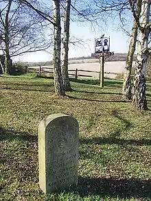
Upper Bush North Downs Way milestone
51°22′31″N 0°26′04″E / 51.37530°N 0.43439°E
Upper Bush is a hamlet in the parish of Cuxton, in the unitary authority of Medway, in Kent, England.
The hamlet has only a few houses, including two Grade II listed buildings; Barrow Hill House [1] and High Birch [2]
The North Downs Way long-distance path leads through the village, between Cuxton and Upper Halling.[3]
References
External links
| Unitary authorities | |
|---|---|
| Boroughs or districts | |
| Major settlements (cities in italics) |
|
| Rivers | See: Rivers of Kent |
| Topics |
|
This article is issued from Wikipedia. The text is licensed under Creative Commons - Attribution - Sharealike. Additional terms may apply for the media files.