 | |||||||||||
| General information | |||||||||||
| Coordinates | 41°54′11″N 12°26′30″E / 41.90306°N 12.44167°E | ||||||||||
| Owned by | ATAC | ||||||||||
| Platforms | 1 island platform | ||||||||||
| Tracks | 2 | ||||||||||
| Connections | Valle Aurelia railway station (FL3) | ||||||||||
| Construction | |||||||||||
| Structure type | Underground | ||||||||||
| History | |||||||||||
| Opened | 1999 | ||||||||||
| Services | |||||||||||
| |||||||||||
| Location | |||||||||||
| Click on the map to see marker | |||||||||||
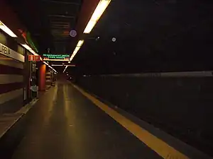
Valle Aurelia is an underground station on Line A of the Rome Metro, situated between Via Angelo Emo and Via Baldo degli Ubaldi. The station was inaugurated in 1999.
The station is situated underneath the mainline station of the same name, so this station is an interchange with the regional railway FR3.
Services
This station has:
 126 Park and Ride places.
 Access for the disabled
 Elevators
 Escalators
Located nearby
- Parco di Monte Ciocci
- St. George's British International School - City Centre Junior School campus
External links
![]() Media related to Valle Aurelia station (Rome metro) at Wikimedia Commons
Media related to Valle Aurelia station (Rome metro) at Wikimedia Commons
- Valle Aurelia station on the Rome public transport site (in Italian)
- Parco di Monte Ciocci (in Italian).
This article is issued from Wikipedia. The text is licensed under Creative Commons - Attribution - Sharealike. Additional terms may apply for the media files.