Vallecorsa | |
|---|---|
| Comune di Vallecorsa | |
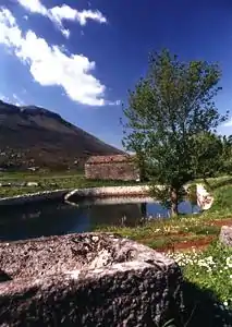
 Le Prata pits. | |
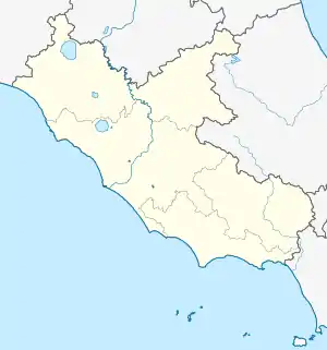
Location of Vallecorsa | |
 Vallecorsa Location of Vallecorsa in Italy  Vallecorsa Vallecorsa (Lazio) | |
| Coordinates: 41°27′N 13°24′E / 41.450°N 13.400°E | |
| Country | Italy |
| Region | Lazio |
| Province | Frosinone (FR) |
| Government | |
| • Mayor | Anelio Ferrracci |
| Area | |
| • Total | 39.28 km2 (15.17 sq mi) |
| Elevation | 350 m (1,150 ft) |
| Population (30 November 2019)[2] | |
| • Total | 2,524 |
| • Density | 64/km2 (170/sq mi) |
| Demonym | Vallecorsani |
| Time zone | UTC+1 (CET) |
| • Summer (DST) | UTC+2 (CEST) |
| Postal code | 03020 |
| Dialing code | 0775 |
| Patron saint | St. Michael Archangel |
| Saint day | 29 September |
| Website | Official website |
Vallecorsa is a comune (municipality) in the Province of Frosinone in the Italian region Lazio, located about 90 kilometres (56 mi) southeast of Rome and about 20 kilometres (12 mi) south of Frosinone, in the Monti Ausoni area.
Economy is based on olive production.
History
The town is known as a fortified borough from around the 9th century AD. The ancient structure is the broken down castle, which was destroyed in a battle. The ancient castle is a boundary between the Papal States and the Kingdom of Naples.
International relations
Vallecorsa is twinned with:
 Monte Sant'Angelo, Italy (since 2009)
References
- ↑ "Superficie di Comuni Province e Regioni italiane al 9 ottobre 2011". Italian National Institute of Statistics. Retrieved 16 March 2019.
- ↑ All demographics and other statistics: Italian statistical institute Istat.
External links
This article is issued from Wikipedia. The text is licensed under Creative Commons - Attribution - Sharealike. Additional terms may apply for the media files.